Using readers and writers to extract and load data.
Recently active
I would like to combine existing text to the point attribute (z-coord). In the picture there is point and line string to point to it. In the other end of the line, there is a text object. All object are separate ones. Only the each object coordinates gives the hint, which text belongs to which point. Anyway Happy New Year from Finland despite the latest ice hockey result. ;-)
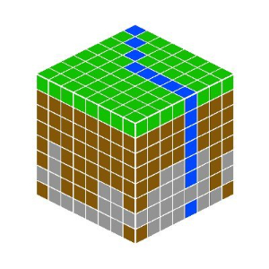
Hi everyone, I'm working on a Minecraft map based on a DEM and some layers, like rivers, vegetation and underground.I'd like to get some tips about how to associate geological layers to a DEM point cloud and then export to Minecraft. I have a .tiff and some .shp files, and I'm using Bowen Island's workbench as a basis, so I think it might be associate to the custom transformer "MinecraftRasterizer". Thanks in advance!
Hello, does anyone know how to create and write microstation dgn text with leader lines? Many thanks, Owen
Hi folks, I've had a look through the knowledge base and tried to find another reference to this, but cannot find the same problem. I have a workbench that pulls data from a couple of our postgres databases, checks it against data in an excel workbook, and, where required, appends new rows to the bottom of the excel worksheet.I'm using the excel writer in insert mode, and using overwrite set to no, having identified the location to start writing by checking the existing data and using an attribute called rownum with a counter to give the row number attribute for the rows to be written to. As this is an existing data sheet the header rows already exist, so the output field names is set to 'No'The existing excel workbook being written to contains a large amount of formatting and conditional formatting, so I have left this as existing rather than trying to apply any formatting via the excel writer or the excel styler transformer. Almost everything works fine, apart from th
Hello,I'm trying to read ArcGIS Online feature services with attachments into a local file geodatabase. I've been able to manage that, however, I noticed every time the script is run, it overwrites the edit tracking attributes. We need to be able to retain ArcGIS Online attributes intact to know who has created/edited the records in ArcGIS Online. Any suggestions on how to keep the attribute intact, so they are not overwritten during the process?Thank you for your help
How I can run two procedure after write using this option.
I've successfully written out text nodes to a DGN following the information in this article:https://knowledge.safe.com/articles/1539/writing-microstation-dgn-text-nodes-with-fme.htmlThe text nodes are displaying in the DGN and look correct, however, FME is generating warnings for each text node being written out and each feature is being logged as follows:Feature specified type fme_text, but did not have the appropriate geometry attributes for this type -- feature has been logged, and will be passed to the writer as-is+++++++++++++++++++++++++++++++++++++++++++++++++++++++++++++++++++++++++++Feature Type: `__GO_TO_FINAL_OUTPUT_ROUTER__'Attribute(32 bit integer) : `Loop to MultiTextCreator_2_MultiTextElementBuilder_2_Input1545672846 Input Splitter.BranchingFactory.Count' has value `1'Attribute(64 bit integer) : `MSLINK' has value `364787'Attribute(string) : `__wb_out_feat_type__' has value `All Levels'Attribute(encoded: UTF-8) : `fme_feature_type' has value `Level 44'Attribute(string) :
Hello, I don't see FME Server on the Azure Marketplace. Can you direct me to "how to" and/or "cookbook" resources for deploying FME Server on Azure? We will have SQL Server already deployed though not sure at this time if that SQL will be IaaS or PaaS.Thanks, Bob
Hi,I'm hoping someone can help me. Is there a way of converting dgn to dwg (including references) or are there issues? I've been searching online and can't seem to find a simple way. I've managed to get the basics but can't seem to get the reference files to come through. Am I missing something? Is there a way to bind them as they go into the DWG?Apologies, I don't use FME enough to remember all the transformers.
I have a 3D model with buildings originally from las data. The model is in polyface .dwg format and for performance improvements I want to split the model into separate buildings. How would I go about something like this? Is there some way of splitting this data using a 2D grid? If so, how do I handle buildings that are being cut into two? Other suggestions?
Can I use a Azure SQL Database (PaaS) as FME Server system database similar to how I use a on-premise Microsoft SQL Server Database?
Working with 2 tables and , my goal is to be able to get a final table that looks like the following table .As observed in Ctable, it is a joined table of Atable and Btable, the values from the Btable are empty except for the depth field. My goal is that for each in Btable.xlsx, the needed values will be sccraped from the nearest value in range to it from the Atable.xlsx e.g. (Depth100 in Btable will get the following values NS(ft), EW(ft) and Date from Depth 206 of Atable, since 206 is closer to 100 than any other numeric values in Atable, 500 depth in Btable will get it values from 492 depth of Atable and this will occur for every depth in the Btable of depth values.Suggestions are highly appreciated on how to get this to work in FME.
I have some data I need to extract some text from, it looks like this: ABC1D, 520 [78580]|XD, 2-6 [DEAD]Info in the brackets can also look like [211 X] and [95338 CO]What I'm trying to do it drop everything except for what is in the brackets, and then filter out/ignore DEAD, and use the number to join(or query, I'm not sure which would be best yet) to another table; or in the case of 211 X match to a different table, or 95338 CO would trigger the workbench to write to a table in SQL. But for now what I need is to get that number in the bracket out to use in FME. Thank you
I am am trying to convert a IFC-file into a CityGML-file. For inspiration I am relying heavily on the intermediate guide for BIM to gis. Now when I am trying to convert the IFCBeam entities into CityGML BuildingInstallation however the workbench crashes and I get the following error:Error running translationI have to the best of my knowledge not changed the writer in any way from the tutorial except for the output-file path and the projection system. Every other geometry I am using seems to convert nicely.I am unfortunatly not at liberty to share the data file. However I have copied the log into two files: Log 1 is the log where I have disabled the beam and the workspace will excecute Log 2 is the log of when IFCBeam is enabled. Which leads to the workbench crashing and I get the "Error running translation"-errorSo my questions are as follow:What does the error mean?How can I solve it?Thanks in advance :D
Hello.We are converting LandXML to 3D tiles and found that 3D tiles generated are not correct. The gltf meshes inside the b3dm files are empty, and we think that property should be populated. The geometry from the LandXML reader is GML dimension 3 geometry. The 3D tile writer is writing these geometries correctly for polygons.Is this a bug or an enhancement to the 3D tile writer?
I have 2234 las datasets covering around 2000 km². I want to reduce the amount of tiles by 1/8 thus increasing the area per tiles by 64.Which workflow could I use to merge neighbouring tiles without overlaps?
I'm new to FME and am trying to transform data in SQL Azure (spatial) and I do not want FME to convert my original types to CURVEPOLYGON. If the original was a MULTIPOLYGON, I want it to remain a MULTIPOLYGON. Even cleanup from the GeometryValidator seems to convert some geometries to a CURVEPOLYGON. How can I prevent this?
Hello, I have two shape files. One file contains more than 1400 points and another is smaller and it has 300 points that are dislocation of some of those 1400 points. I would need to calculate the differences between those points that are from shape no1 and same points that are present in shape no2. I taught that it can be done by NeighborFinder but I am not sure how. Any help and hints is more than welcome. Thank you in advance, MaliodPalube
When use generic reader on dataset on local disk works fine but when hit through URL and workbench gives back this "Generic Reader: No valid reader name specified, guessing reader name from dataset" and failed to load dataset
My goal is to provide a live updating KML file to be displayed in Google Earth for Chrome. My process is to create a KML file and then upload to Google Drive. The problem is that the new upload becomes a new file with a new location, so Google Earth doesn't know where the latest KML file is. Instead, I just want to update the existing file. Maybe GoogleDriveConnector doesn't have that functionality?One option would be to create a Google Drive API Python Script, but that doesn't seem very FME-ey. Thank you for your assistance.
My FME Server Dashboard is showing 3 months of logs, is there a way of only showing the last 2 months of logs?
I am trying to add an ArcGIS Server Feature Service reader to my workspace but get the following error when I click to get the Layer List: Python Exception <HTTPError>:401 Client Error: Unauthorized. I suspect the issue is a dash in the URL, which goes something like https://server-new/arcgis/rest/services/MyMapService/MapServer. I can't add any of the map services from this ArcGIS Server. However, we have several other ArcGIS Server environments and I don't get the error with any of them (and none have dashes in their names). Could the dash be the issue? (FME Desktop 2016.1 - build 16492)Thanks,Aaron
Hi All,I am comparing pdf's and getting the changes (Added/Deleted). It works fine. Only one scenario I was facing the issue with different scale pdf. (one is 640km scale and another one is 360km scale) this case I am not able to find the changes. Could anyone can help with this?
Hi,I´m using FeatureWriter to save my DWG file, but after executed my workspace, the DWG file show me all features duplicate. If I use the writer REALDWG work good, but I need to use FeatureWriter because it´s possible use autocad_source_filename for Template File.Why all features are duplicated in FeatureWriter? Thank´s
Hello.I'm trying to convert Land XML to 3D Tiles and running into some problems. I've tried both Cesium ION Connector and Cesium 3D tile writer, and an EsriReprojector to convert state plane coordinates to WGS 84 .Both complete the conversion without errors in FME. However, each method has some additional issues. Using the 3D Tile writer, I use a Land XML Reader, to EsriReprojector, and directly to 3D Tile writer (do not use ION connector). I cannot see the3D Tiles in Cesium. I do not get any errors in Cesium and Cesium viewer is successfully loading the tiles.I've also tried LandXML, to CityGML, to 3D Tile Writer, but that does not create a data Directry. Creates the tileset.json file though. Using the Cesium ION Connector, I followed this example:https://knowledge.safe.com/articles/81161/uploading-assets-to-cesium-ion.htmlI converted the Land XML to CityGML, then push that to the Cesium ION connector. When I go to the Cesium ION account assets, an error is displayed about