Using transformers to modify data.
Recently active
Hi, I'm trying to create a file which summarises my data, based on monthly counts. My data:Job1 Dogs 01-01-2018Job2 Dogs 14-01-2018Job3 Dogs 22-02-2018 etc.. My summary file is:Raised Jan-2018 2Raised Feb-2018 1 etc.. And I want to be able to run it for this month, and it append on the end "Raised Aug-2018 22" based on the count of this month.
Hi everyone. Hopefully there is a solution to this. I have some DWG files that have a custom projection. However they are not projecting in the correct position by a long way. I believe there is some kind of off set and or rotation applied to the model, that I can not seem to get FME to ignore. If I take the same dwg and put it in ARC Map and define to the projection, it sits fine. So appears ARC Map is ignoring what ever FME is not. Any help greatly appreciated. FME inspector (you can see its rotated to be straight)FME inspector (data in the green, in the ocean)Arc Map same data in same projection
I'm completing a government return which will need to be sent daily and they require the file to be named as below:"File naming: CAZ-yyyy-mm-dd-XXXX-#.csv where:yyyy-mm-dd represents the date the file was generatedXXXX is the agreed identifier for each Licensing Authority (to be confirmed)# is the total number of records included in the file."The date is easy enough to solve, but I'm hitting a brick wall trying to insert the feature count into the file path. So far I've got:CAZ-@DateTimeFormat(@DateTimeNow(),%Y-%m-%d)-XXXX-#Could anyone help with the #?
I am working with kml file converting it to our database format and extracting some information along with the shapes. One of the attributes of kml has the info that I need. It looks like that (which seems to be html format):<center><table><tr><th colspan='2' align='center'><em>Attributes</em></th></tr><tr bgcolor='#E3E3F3'><th>AlertID</th><td>18112330</td></tr><tr bgcolor=''><th>DateTime</th><td>20181222124132.000</td></tr><tr bgcolor='#E3E3F3'><th>AlertRegionID</th><td>2111030</td></tr><tr bgcolor=''><th>RegionTypeID</th><td>1</td></tr></table></center> From that one attribute I'd like to extract the important info minus all the tags, brackets and formatting as separate attributes:AlertID 18112330DateTime 20181222124132.000AlertReg
I'm reading an Oracle Date field in my reader, and then using that date to update a Date field in another Oracle table using SQLExecutor, but I'm getting "`ORA-00932: inconsistent datatypes: expected DATE got NUMBER'." How is that possible?Any help and explanation will be much appreciated.
OK, there must be an easy way to do this, so sorry for asking. o_O; I have 3D polylines with z-values only on the start and end node coordinates. Using the MeasureOrZvalueInterpolator I have calculated measures for the z-values for the intermediate vertices, and with the MeasureExtractor I have also turned these into a list attribute. Now, my question is - How can I transfer these values to the z-coordinate values of my intermediate vertices, so that my lines will be in "full 3D" for all coordinates?
Hi EveryoneI have .txt as attached, the first line is the schema and separated with "tab" space. I can open this is in excel like .csv however I want to read this in FME and create attribute for each schema at first row. I tried attributesplitter with "tab" as delimiter but it seem not as what I want. Can anyone show me how to do it?the input file Expected attribute to be in FME to processThanks.
Hi, I'm looking for a way to read all the tables which are in one schema without having to select them manually. I have to export all the table which are stored in one particular schema in spatialite. New tables can be added end old one deleted. That's why I need something automatic... Does anyone have a clue ? Thank's
For example:I've got 4 solids all in dwg. I would like to combinate the layernames of the overlapping objects.So how can ik get the layernames in the green boxes? And I'm looking for a solution which als works if I have multiple flat solids (linke the blue and grey ones) Thanks!
HelloNot very familiar with raster. I have a Vector Polygon and two Tiff files, basically the Polygon has clipped these 2 tiff files from other application. Now when I try Inspect the data through fme both vector and raster are miles apart. The 2 tif file sits exactly on the same location and its coordinate system is unknown. I think the problem is with Tif file as it is not Georeferenced at the correct location. There are other support files in the same folder as tif which fme is not able to read(warning) I have tried lot of things (including manually assigning the coordinate system) but every time the two rasters are exactly at the same location and far from Polygon. As my knowledge with raster is very limited, can anyone help me load the tiff at correct location. ThanksZubair
I would like to create a dwf from dwg-layouts, but I can't fix that.Does anyone has a example workspace? Thanks a lot!
I would like to export several dwg-layouts to dwf-files. On a strange way I only can see the modelspace in the dwf. Does anyone has a example workspace for this?Thanks a lot!
Hi GuysI am trying to count the occurrence of a value across a large number of attributes. All the attributes have a different name, however they all have "_SIG" in their name (a value that rates significance). Ie ENVIA_SIG, WATRF_SIG etc. There are heaps of them and I want a way to just test those attributes using a wildcard of sorts. Basically I would like to use a tester to test for the existence of the number 5 in all attributes that end with _SIG. However in the tester (or Test Filter) I have to manually add each of those attributes which is not realistic as there are over 50 of those attributes. Any suggestions would be greatly appreciated!Thank youDominique
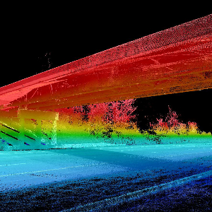
I use a PointCloudFilter where I try to find the lowest parts in a PointCloud.In this way I get two long straight stretches of PointCloud remainders, which are clearly seperate and quite far from each other (i.e. >10 times the distance of points in the Pointcloud).My problem now is how to split up those different parts/groups of the same PointCloud so I can use each remainder independently ?PointCloudCoercer -> "Single Multipoint" + HullReplacer doesn't give me different parts.I could not find other ways to tile/split PointClouds in the way I need.Any ideas ?
Hi, i have a dgn file. that consists of line,area and text. i need split the line using those intersected areas.that was performed using lineonareaoverlayer. my doubt was how to measure those lines. i need length of each line. what transformer use for that? anyone give the solution?
Hi, I have a dgn with point,line,area,text. I want split the lines using area.that was performed using lineonareaoverlay. in some areas like junction have two lines. how can i join those lines in those areas and i can calculate the length of each line inside the area.Actually i can performed lengthcalculator for measure the length of each line. my problem is in some junction areas have two lines how can i join those areas only and calculate the length
I have attached a spread sheet with some dummy data to help explain my question. I have a number of Locations and Events with the Easting and Northing for each. I need to calculate the distance between each of the Locations and a number of Events. Outputting the result in a table Distances in km between each of the two points. Loc1 and E1 etc.On the real data I need to calculate the number of Events that happen at 1km, 2km and 3km form each Location.The dummy data spread sheet has the input data on Tabs Locations and Events. The required format of output data is show on Tab Distances.
My client has several dgn files that contain 3d_solid objects (pipelines and other vector data). I have a workbench on our FME Server that will convert drawings into shapefiles but the solid objects are not going through. The igds_type is igds_3d_solid until I try aggregate them or assign them to 3D or 2D.One thing I also notice is that on some of the geometries not reading through the igds_type does not equal the fme_geometry. For example, I look at the dgn before processing and one of the vectors is igds_type = igds_line, but the fme_geometry = fme_polygon.
Hoping someone can help me out. I have a geometric network of wells, pipelines and facilities. I have already ran a custom ArcHydro python script to break the pipelines up at every junction point and give the pipelines unique HydroIDs, ToNodes, FromNodes and NextDownIDs (which indicates which pipeline, AKA HydroID, to flow to next). The wells produce water and I can add the monthly production values from the wells to the adjacent pipeline using the Bufferer and SpatialFilter transformers. I'm now trying to find a way to add the production through the rest of the pipelines. I have NextDownIDs, which I thought I could maybe just group the pipelines by all pipelines that share the same NextDownID field and add the production values in the Water_Production fields together, however this adds the values incorrectly because it doesn't add the pipelines in order from well (source) to facility (sink). Does anyone have an idea of how I can use FME to add the production values up correct
When trying to convert from NAD 83 State Plane Alaska Zone 3 US Foot to WGS 84, I receive the following error: Reproject: Could not reproject the geometry of the preceeding feature: Reprojector: Invalid reprojection parameters. After doing some research I have determined I am needing to create a datum grid shift file. However, I am unsure what information to use to populate this datum. Can anyone provide any help?Thanks!
New user here so be patient! I would like to remove from a KML all the geometry (point, lines and areas) that are outside of an arbitrary bounding box (let's say a square defined by the corner coordinates). I tried using a Tester but I can't seem to get the numerical values of the of the placemark. With the following parameter I get always "passed" even if the points coordinates don't respect the condition:Moreover this approach will be problematic for lines and areas. I tried multiple transformers but with no success. So does anyone have a suggestion on what will be the best approach for filtering this data? Thanks!
I have about 30,000 OSGB files, I want to convert them into ONE file that accepted by InfraworksThe file types below are both supported by Infraworks and FME, and they also support Coord .sys in FME.Autodesk IMXCitiGML (Use CityGML importer for Infraworks)LandXMLSDFSHPQuestion:1. Which file format should I use?2. how to convert 30,000 osgb files into one (e.g. IMX) file in FME?sample osgb file is attached.
Hi, One of our customers has customized the S57 Reader as explained in https://knowledge.safe.com/articles/570/s-57-enc-hydrographic-data-format.html. He is concerned by the fact that all customized files are replaced whenever a new FME version is installed, or that the customization should be done again if a new FME version is installed at another location on disk.This might be acceptable for one user, but this causes much more trouble as the customization has to be performed on all workstations used in the company.I suggested having FME (or the GDAL S57 format used ultimately) check some location (for example in FME shared directories) for a customization of the format and @danatsafe has filed the FMEENGINE-61034 change request.Anybody who finds this is a good idea, please vote or suggest any other improvement to the S57 customization process. Thanks.Fred
Hello! I am going through a very weird situation where a quite good amount of roads(~10M) are shifted randomly upto10m in a random direction that impacts junctions, 2-way traffic roads, dead-end roads, roundabouts, etc,Here is what I have been trying to do:- Finding out the building footprints (BFs) that are towards the road (since they make a uniform line)- Shift the roads, roundabouts at the center as per the BFs. In cases where the buffer(miter) of 5m touches the BFs, only those roads are to be updated (since BFs might not exist).Cannot think much about other generic solutions. Any ideas?- pink polygons are the BFs, dark pinked polygons inside are the donuts filled.- Redpolylines are the road geometry.- Basemap is added at the back.Also attached the BFs and road geometry data. I don't know if there can be a generic solution for this, but scenarios can be taken into consideration. That's what I am trying to analyze now! Thanks!
Hello FME Gurus,I have a puzzling situation that I am trying to overcome while trying to validate the length of line segments from my DWG file.In the drawing there are labels which define the running chainage distance of a straight line. The chainage distances start from a zero position and a running distance is given at intervals along the line. The interval may be a single line segment or a combination of multiple straight line segments. In the example above there is a label of 84.05 metres and then one of 117.57 metres hence a line segment length of 33.52 which is made up of two line segments of 14.00 and 19.52.My thought process is to get the x and y coordinate from the label 84.05 and the x and y coordinates from the label 117.57, create a line and do a line on line overlayer or neighbor finder, get the list of closest lines with the same bearing and then get the combined length of the lines between the two points.My problem is I just can't figure out how to iterate through