
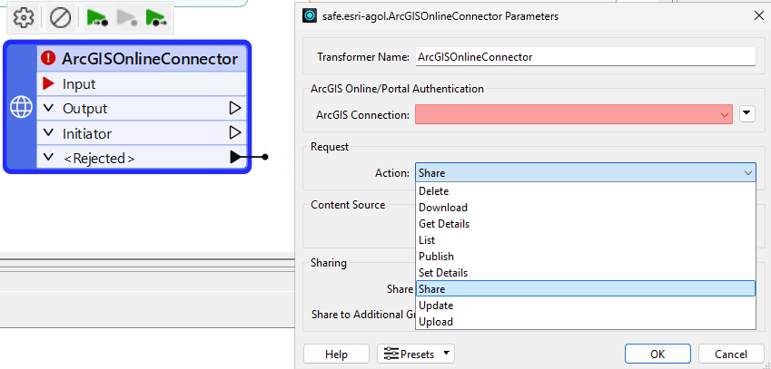
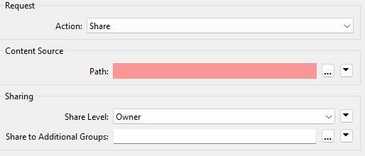
I have a workbench that can take in various formats, at present vector and web services, and publishes these items to ArcGIS Enterprise Portal.

I would like to extend the functionality to enable the users to also upload raster imagery i.e geotiff, jpg, etc.

I am using a HTTP caller to use the ArcGIS API additem call to add the file to portal and then using the API publish to publish the image, but it never works.

I can do it via ArcGIS Pro and end up with a ‘Map Image Layer’. 

But I can’t figure out the correct process starting with a zipped file containing the image and ending up with an item in ArcGIS Portal that can be used a map service.

Any advice would be greatly appreciated. 


There is a second API call you need to make. The one you’re currently using (addItem - https://developers.arcgis.com/rest/users-groups-and-items/add-item/) just uploads a file to AGOL. Onces its uploaded, you need to publish a service with the source data being the item you just added. Take a look at the publish endpoint - https://developers.arcgis.com/rest/users-groups-and-items/publish-item/


@hkingsbury thanks, I am using the publish item but I just can’t get it to work where the image is available to use in Portal. I must be using the wrong type or other attributes. Thanks again for taking the time to reply.


The AGOLOnline/PortalConnector has all these API calls implemented as “actions” into a UI.

For arcgis online you need to Upload, Publish and then Share the item to the Organisation as a whole… or alternatively share just as Owner but add a smaller “Group”


Thanks ​@j.botterill , I will give that a go.