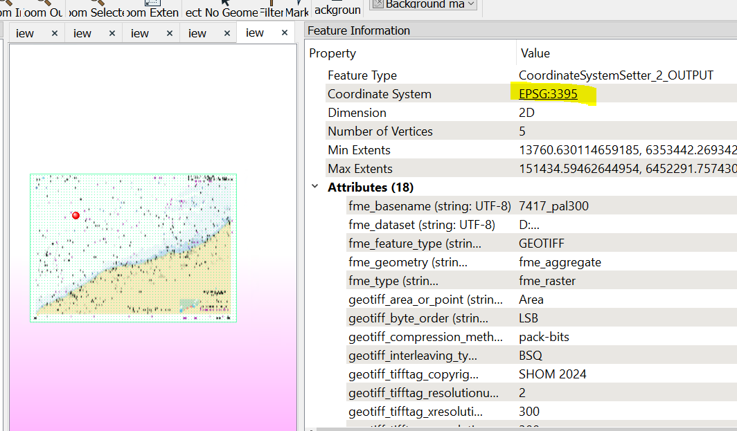
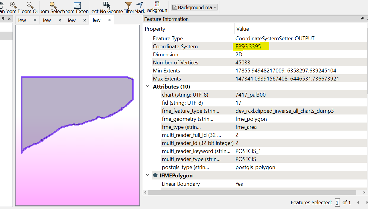
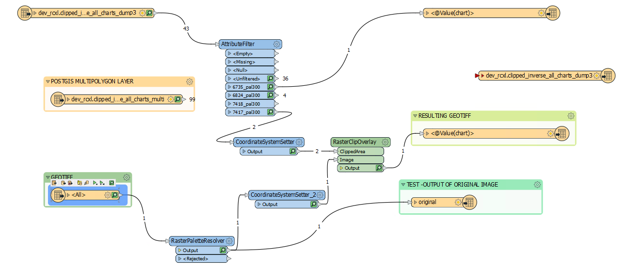
I'm trying to use RasterClipOverlay to extract an area on GeoTIFF defined by a polygon. FME is currently giving me the incorrect area. The Workspace:
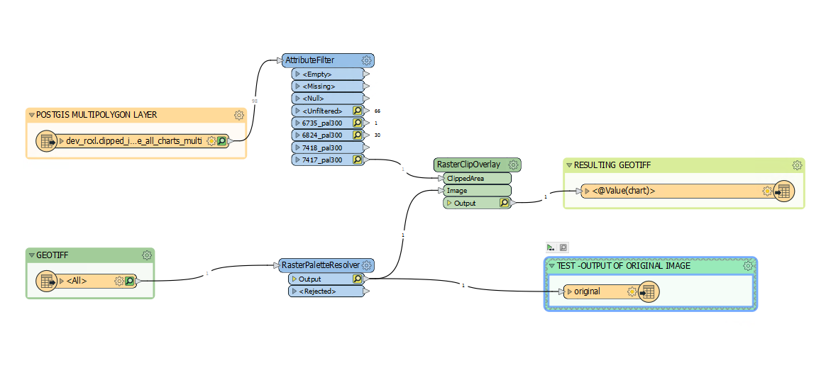
The workspace has a polygon coming from a POSTGIS layer which is filtered. It also has an GeoTIFF both of which are inputs to the RasterClipOverlay. The results are output to a GEOTIFF. As a test I have also added a simple output image that does not come from the RasterClipOverlay. Both the polygon and image are in the same projection EPSG:3395.
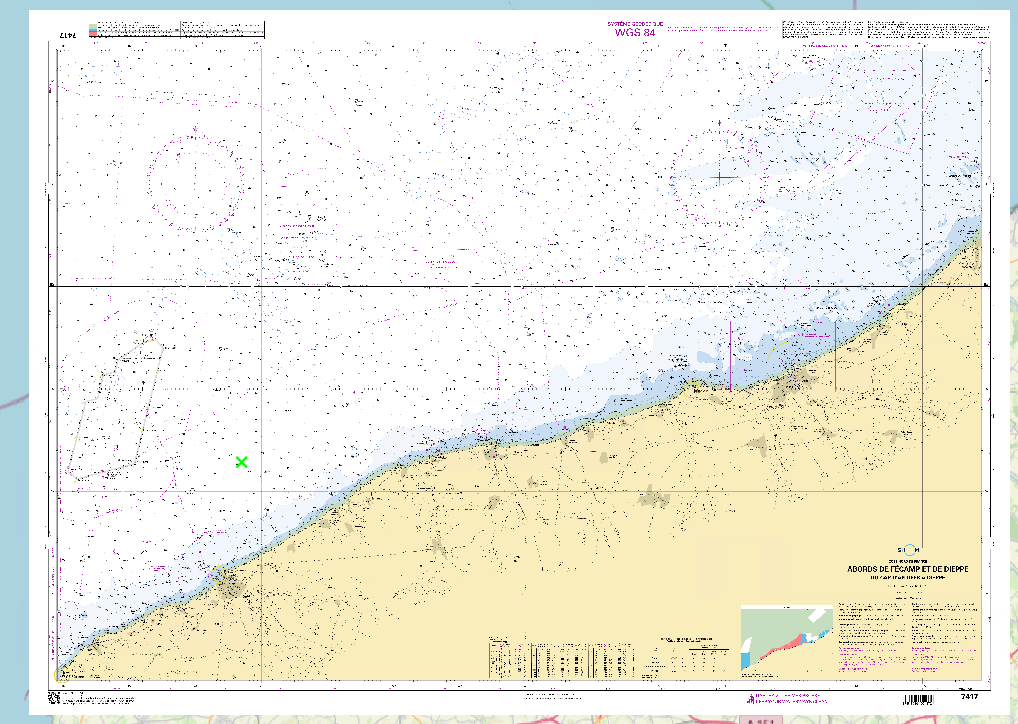
The original image (displayed in QGIS):
The polygon (in QGIS):
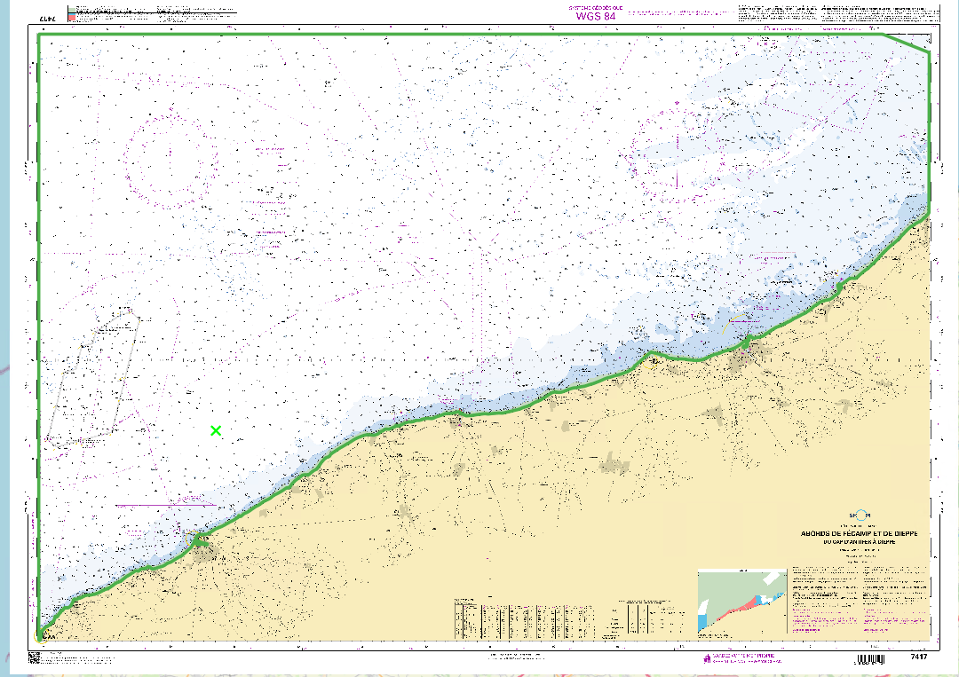
As you see from the results, the area of the map is not correctly extracted. The polygon is supposed to cut out the sea, however, it also cuts the map boundaries and part of the land. The shape of the cut is correct however the map is “shrunk” hence the area of the map is incorrect.
This is just one example, I have various other maps I’m working with and the problem occurs in all of them. If I use QGIS /GDAL then the results are correct, however, I want this to work in FME.
The test output that does not get clipped does display the correct map in the correct location.