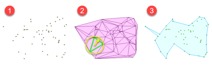
I’m looking at an area of survey points that can be divided into east and west areas by grouping with an attribute value. I have used Hull Accumulator to draw polygons around a) the whole area (light purple) and b) the two subdivisions (darker purple). The point population remains the same overall, but I get different external boundaries in places, when I was expecting the same. Alpha = 0.
What would be useful is any description about how the transformer makes its drawing choices.
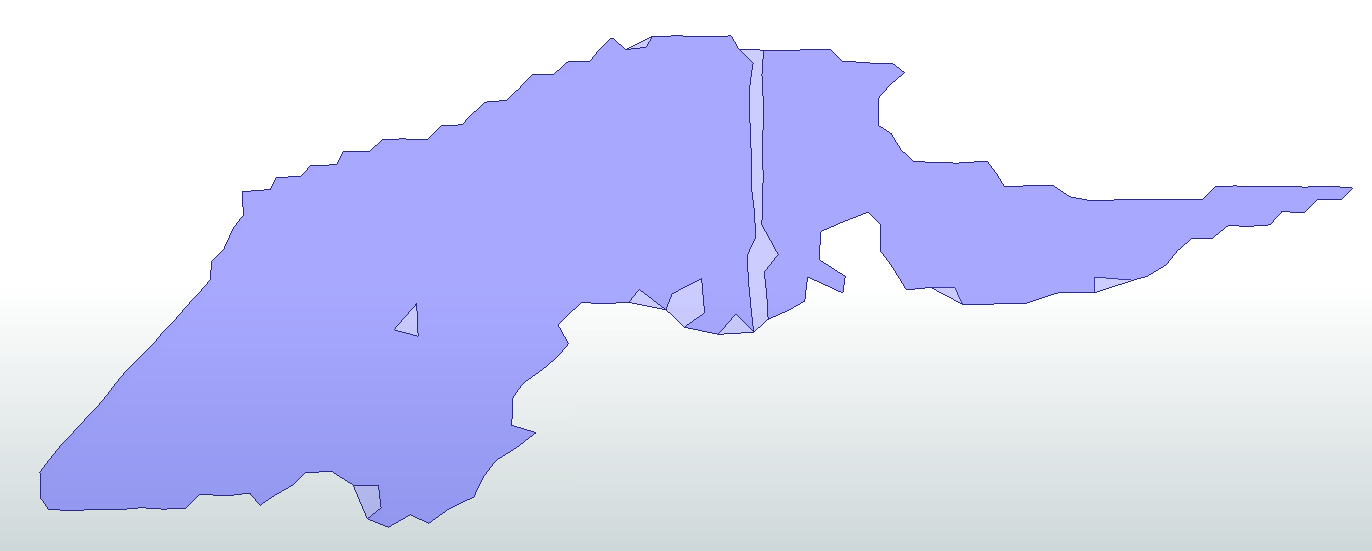
I also end up with a donut hole. Again, am trying to understand how this occurs, as I assumed the transformer would create an external boundary only.
Many thanks