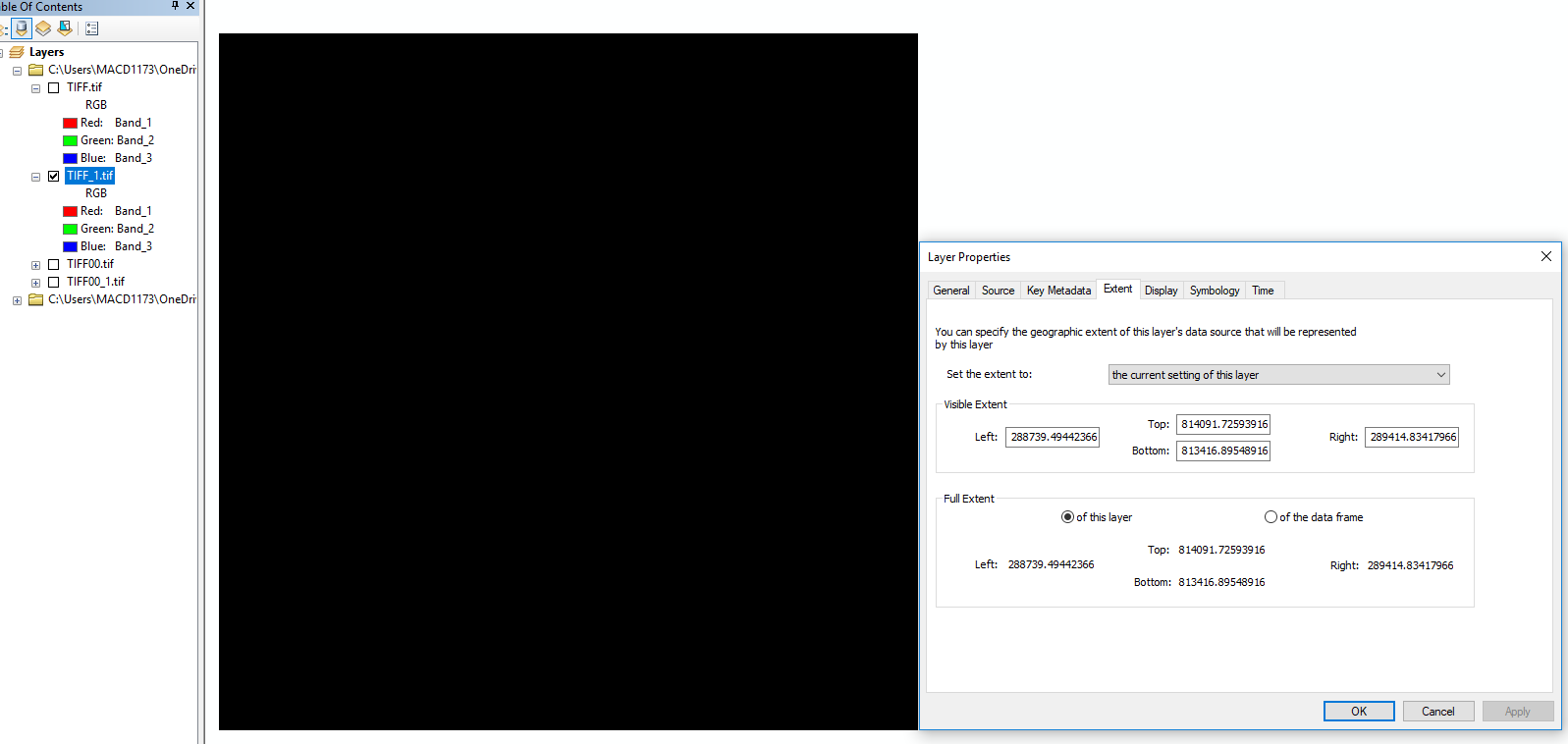
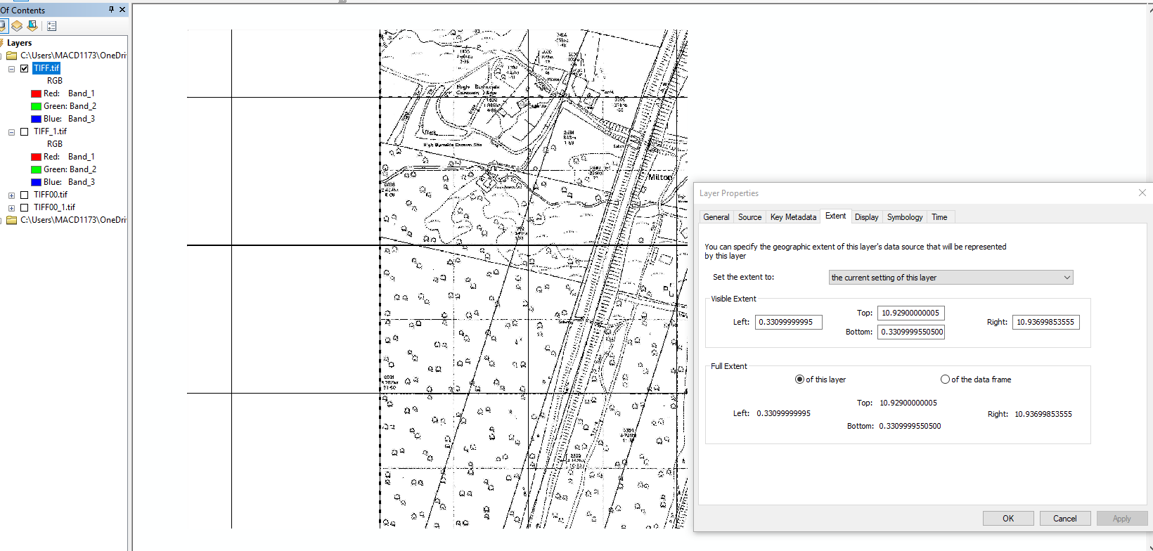
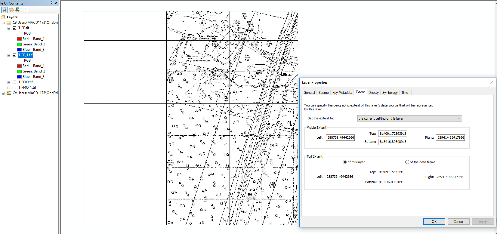
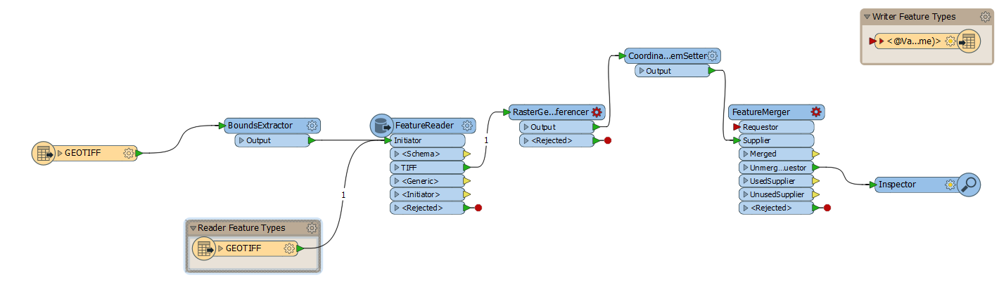
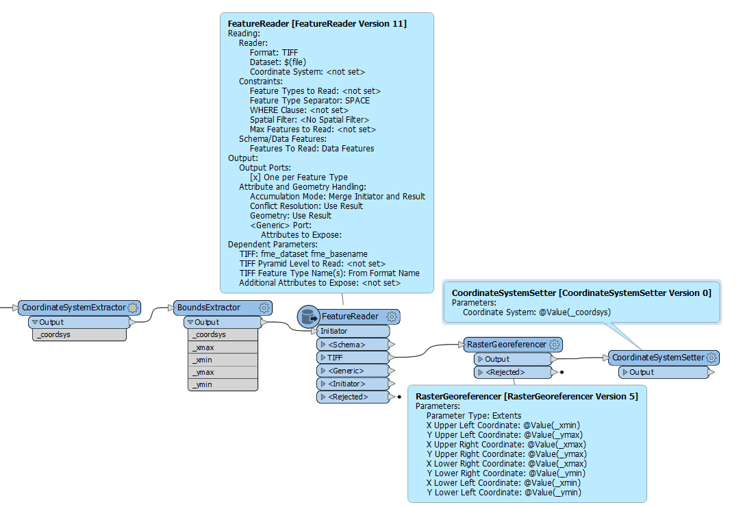
I have 2 .tif files (1xBounding Box with correct extent and 1xRasterMap image with wrong extent).
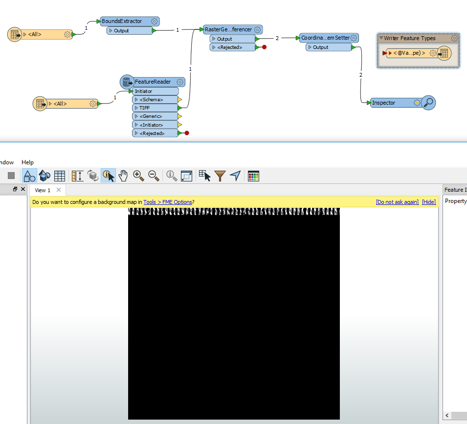
Please can someone show me an example (or list of tools) how to import or get the correct extents from a bounding box .gif raster file into another .gif raster file (map) with wrong extents. I've tried BoundsExtrractor, BoundingBoxReplacer, RasterCombiner, ExtentsCoercer & Merger/Georeferencer but can't get what I need! The images below illustrate what I mean. Any help appreciated! Scottaidh
Georeferenced tif