Hello,


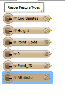
I am working with DXF files which are outputs from Leica GPS units.  When I bring the DXF into FME as a reader it displays the point data and attributes as seperate individual features.  What is the best tranformer to use to combine these into one point feature with an attribute from each one.  My goal is to end up with a point feature in a file geodatabase.


Thanks in Advance 


You should check in the data inspector for a common attribute.


Like maybe a timestamp.


Such attributes are often hidden but can be expose using a attribute exposer (and probably entering it manualy)


Then u could feature merger to merge them on this attribute.


U can create the points with a 2D Pointreplacer using the coordinates. And even add a z value from heigth.


Reply