
Hi Everyone

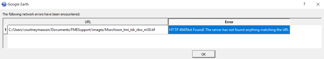
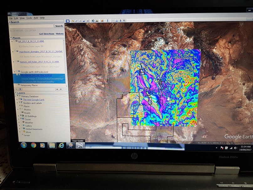
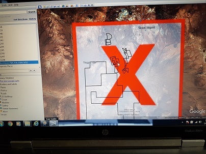
I am new to this software and forum. I have been converting ECW files to either TIFF or KML, with the ultimate aim of overlaying these images in Google Earth. I can get the TIFF's I generate to open in MAPINFO or picture viewer, but not in Google earth. Also my KML files that I generate don't open in Google earth. I just get error messages. Help please..

Kelvin

Hi @geologyrocksme,

What kind of error has your KML?

Thanks,

Danilo


@geologyrocksme, can you please attach one of your KML files and/or the error messages you are receiving from Google Earth? A screenshot of your current workspace might be helpful as well.

Courtney


@geologyrocksme, can you please attach one of your KML files and/or the error messages you are receiving from Google Earth? A screenshot of your current workspace might be helpful as well.

Courtney

Hi @courtney_m, we sent at same time the message... :)


Hi @courtney_m, we sent at same time the message... :)


Great minds think alike. 🙂
Great minds think alike. :-)
Yes 🙂


@geologyrocksme, when I tried opening your sample KML file in Google Earth, I got the following error:

So the KML file requires access to the TIFF specified on the left side of the dialog, but, since I do not have that file, the KML fails to open properly. Have you verified that you have the TIFF with the exact path name listed in your error message?

Courtney


Hello, I have tried multiple times without success. When I use 'open file" in Google earth I get the image above, but when I go to "add image overlay" I get the big red cross appear on Google earth. Why?


I have added screenshots of my steps involved in creating the step-1.jpgstep-2.jpgstep-3.jpgmages


Hello, I have tried multiple times without success. When I use 'open file" in Google earth I get the image above, but when I go to "add image overlay" I get the big red cross appear on Google earth. Why?

Hi @geologyrocksme,


I saw your images now and i did understand your problem.


You need to handle the source raster in kml. And has a interesting link that describe how to created this process. Writted by @NatalieAtSafe


Raster handling in KML


Thanks,


Danilo

Hi @geologyrocksme, I think your workspace converts ECW dataset to GeoTIFF dataset. Firstly check if the workspace performs the conversion as your expected. If there is any problem here, please explain about the situation specifically.

Then, if your final goal is to create KML or KMZ dataset containing the raster, you will have to replace the GeoTIFF writer with a KML writer, and also add some transformers to the data flow.

Tips: It would help you to configure relevant parameters including Reader/Writer/User parameters if the Navigator window would be displayed on the Workbench interface. Check Workbench Menu: View > Windows > Navigator.


Reply