Question

CAD .DWG templates to a specified coordinate location on Earth

  • May 3, 2019
  • 1 reply
  • 66 views

Hey Everyone,

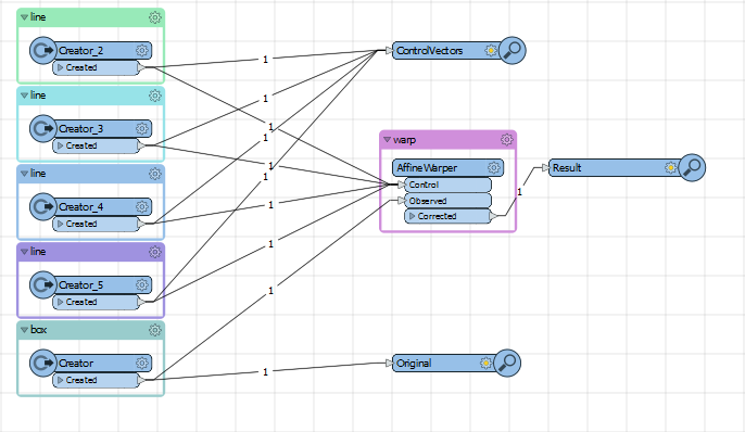
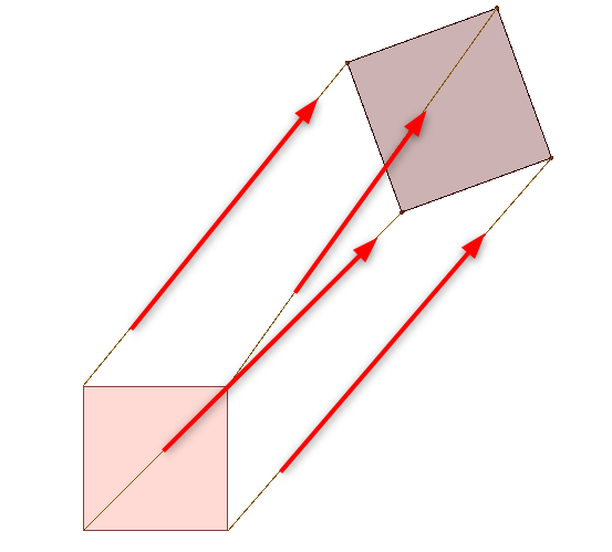
My group has a number of dwg files that are multi-vector diagrams of a structure. The final output would be a GDB environment. Writing to a GDB is easy enough but there is no coordinate information attached to it. The template is meant to be placed anywhere we desire on the planet. If there was a center point in the middle of the multiple vectors, is it possible to have FME reference everything to the coordinates point that are supplied by the user?

This post is closed to further activity.
It may be an old question, an answered question, an implemented idea, or a notification-only post.
Please check post dates before relying on any information in a question or answer.
For follow-up or related questions, please post a new question or idea.
If there is a genuine update to be made, please contact us and request that the post is reopened.

1 reply

nielsgerrits
VIP
Forum|alt.badge.img+64

What you want is called georeferencing. And yes it is possible.

If you only need to move over XY you can use the Offsetter transformer. Set the corrections in the paramaters and you are good to go.

But georeferencing usually involves moving, rotating and scaling. If you also need to rotate and scale you can use the AffineWarper or RubberSheeter transformer.

With those you need at least 4 vectors (from-to lines) to calculate the transformation of the data.

affinewarper2019.fmwt

If you prefer to fix this in AutoDesk software, the command is ADERSHEET.