
Question
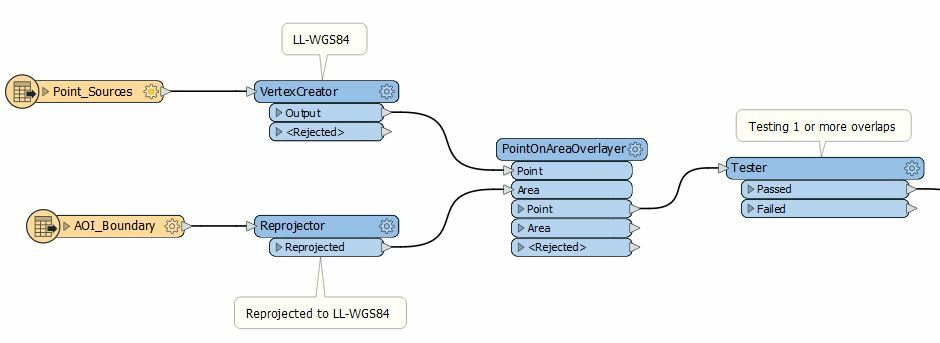
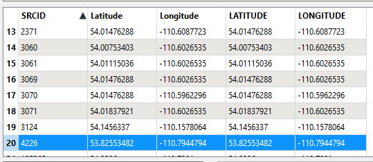
I have data in Excel with Lat/Lon converted to points using VertexCreator in LL-WGS84 and an AOI-boundary shapefile converted to LL-WGS84. When I clip the points lying within the boundary using PointOnAreaOverlay, the resulting points are 400km east

 After StringReplacer:
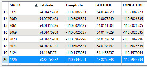 which is what you would expect. I've possibly missed something so perhaps you can highlight a specific SRCID in the data where it looks like the data has changed.
Login to the community
No account yet? Create an account
An FME Account is required to contribute
LoginEnter your E-mail address. We'll send you an e-mail with instructions to reset your password.