Hi All,
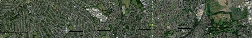
I am trying to merge several raster tiles into a single one using RasterMosaicker. Unfortunately, in the output raster you are able to see horizontal and vertical white lines as well as a horizontal black line at the bottom.
Please note these are not present after georeferencing the tiles and is only after the used of the RasterMosaicker transformer that they appears.
Is there a transformer I need to use prior this or are the parameters within the RasterMosaicker the ones need altering?
Any ideas welcome!
Thanks,
Ana


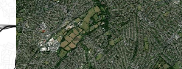
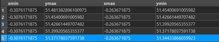
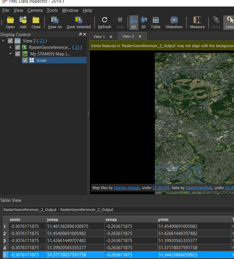
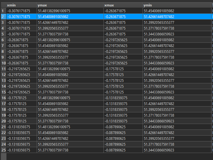
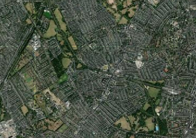
 The thing is that after the set of images are georeferenced the raster images seems to snap perfectly as per image above. It is true that the line seems to always be located before the end row of images. I also notice that when I extract the properties of the georeferenced raster the columns and rows are 256x256; whereas after using the RasterMosaicker 1282 rows x 1280 columns.