Morning

I am trying to calculate the difference between coordinates of 2 stations. I've attached an image to assist in explaining. If you reference the image I've attached, you will see that lines 1 & 3 are the same station, and 2 & 4 are the same station also. Eastings and Northings provided on lines 3 & 4 are the accurate coordinates. Is it possible to calculate the difference and have it outputted?

I need to use this data to make an adjustment to some spatial data based off this calculation, well, to start.

Hi @gavin_082,

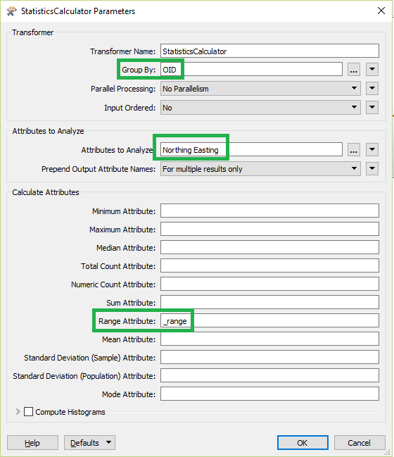
I think this can be achieved using StatisticCaluclator transformer as given below.

'Range Attribute' calculate the difference between two values in Northing and Easting attributes group by OID.

Regards,

Priyantha


Hi @gavin_082,

I think this can be achieved using StatisticCaluclator transformer as given below.

'Range Attribute' calculate the difference between two values in Northing and Easting attributes group by OID.

Regards,

Priyantha

Awesome, thank you, that has given me the result I was after.


Do you know of an easy way to either add or subtract the outputted "_range" against the original eastings and northings?


Awesome, thank you, that has given me the result I was after.


Do you know of an easy way to either add or subtract the outputted "_range" against the original eastings and northings?


You can use Offsetter transformer to offset the original values in the feature. Consider multiplying the value by -1 (ExpressionEvaluator or AttributeCreator can be used) when required to substract.


Reply