Question

Automatically Georeferencing PDF

  • February 5, 2020
  • 1 reply
  • 90 views


I use the RasterGeoreferencer with the Option all 4 Corner Coordinates to Georeference.

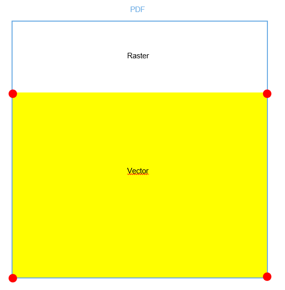
I export the map from ArcMap to PDF. The PDF has a part with Raster Data and a Part with Vector Data the same way as the Picture above. The Red Points are the Coordinates that i have (means i make a Bounding box and then a coordinate extractor list exploder) and after the RasterGeoreferencer the PDF has the shape of the Vector. Its squeezed together.

Is there a better way i can automatically georeference the pdf?

Can i export only the Vector Data from ArcMap?

Any idea's would be helpful.


This post is closed to further activity.
It may be an old question, an answered question, an implemented idea, or a notification-only post.
Please check post dates before relying on any information in a question or answer.
For follow-up or related questions, please post a new question or idea.
If there is a genuine update to be made, please contact us and request that the post is reopened.

1 reply

owen
Forum|alt.badge.img+1
  • February 6, 2020

Hello. If you have the option to use ArcGIS Pro then you can choose to create a georeferenced pdf.


Cookie policy

We use cookies to enhance and personalize your experience. If you accept you agree to our full cookie policy. Learn more about our cookies.

 
Cookie settings