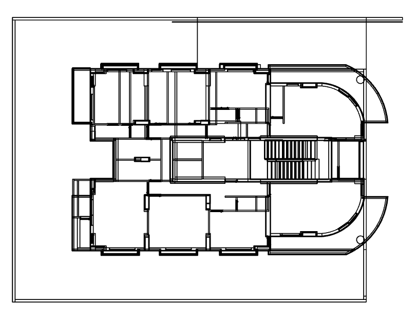
 I have a file that has been converted from .ifc format to citygml format and I want to convert it to a shapefile. There is a problem with the coordinates and dimensions of the building. If the modeling is done, as shown in the following figure...Suggest me a set of solutions, please.?

Solved
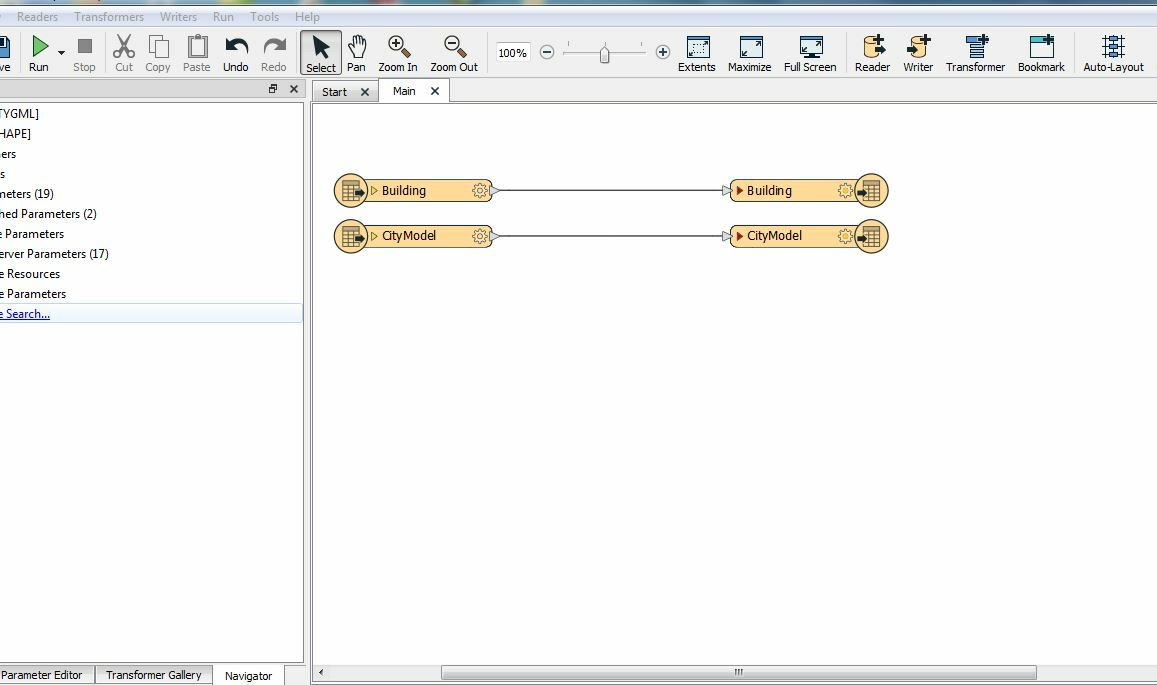
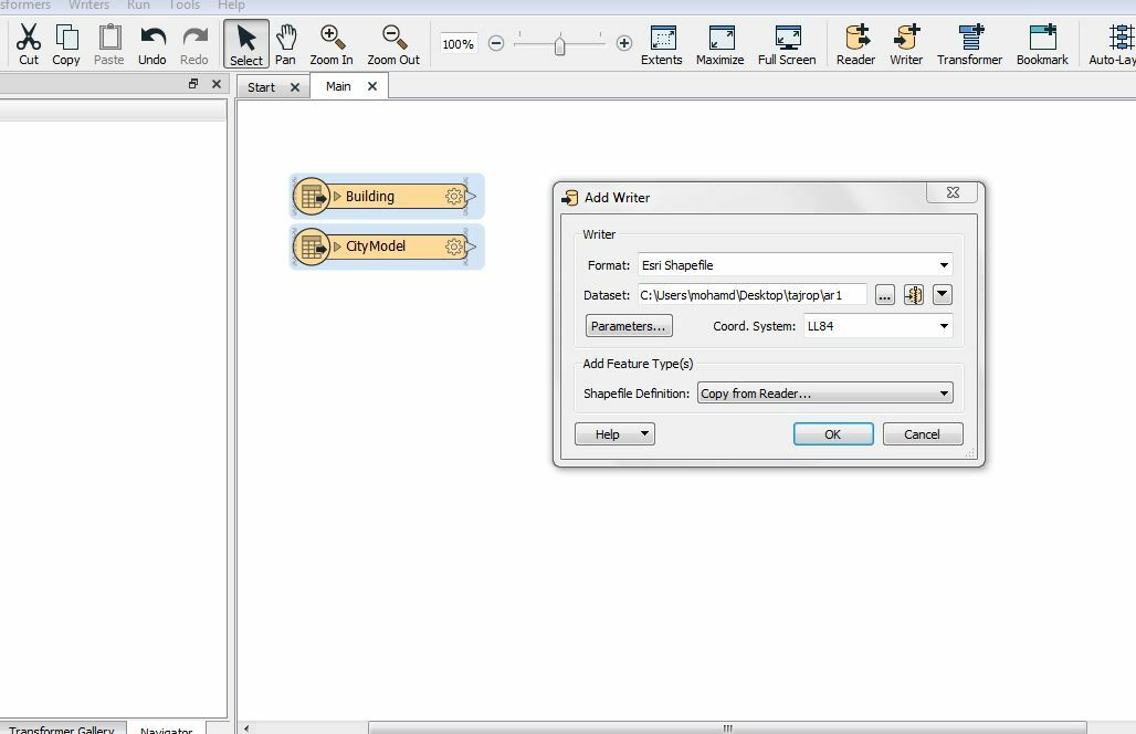
Please, does the image workspace convert citygml format to a shapefile?


Best answer by evieatsafe
Thank you for your interest in helping me solve this problem
I'd like to convert this file from citygml to a shapefile with a location for the build on the map
Thank you @mohamdwassouf for sharing your file.
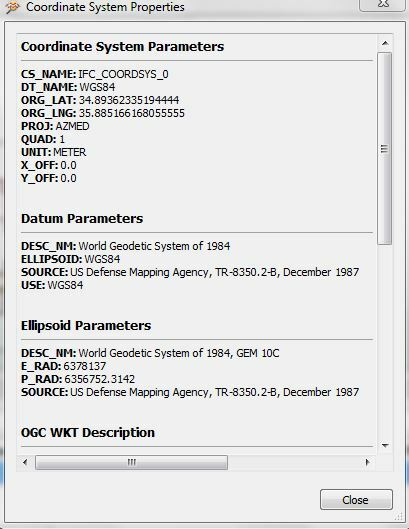
looking at your file, I see that it does transform the CityGML to shapefile perfectly fine (with a few missing attributes as mentioned previously); however, even though it does have a coordinate system it does not seem to be georeferenced.
 If you know where this building is supposed to be located, you can add this information manually in FME perhaps by using a combination of the GeometryReplacer, the LocalCoordinateSystemSetter, and the Scaler. Check out this article for more ideas on how this might be possible.
This post is closed to further activity.
It may be an old question, an answered question, an implemented idea, or a notification-only post.
Please check post dates before relying on any information in a question or answer.
For follow-up or related questions, please post a new question or idea.
If there is a genuine update to be made, please contact us and request that the post is reopened.


Login to the community
No account yet? Create an account
An FME Account is required to contribute
LoginEnter your E-mail address. We'll send you an e-mail with instructions to reset your password.