[Software ArcCatalog 10.3 with Data Interoperability] I have a group landxml files that I coerced into polygon shapes, performed some text editing (i.e. extraction), and then filtered into two different workflows. These files include an attribute for the parcel numbers (Name)
I also have a group of excel spreadsheets that contain the information about these polygons, and were modified by attribute split and some string replacement. They also include a column for the parcel numbers (Parcel_list) that was created through the modification.
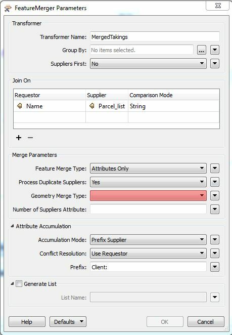
Using the FeatureMerger, the Excel table was brought into the supplier port, and the polygons into the requestor port. The parameters have the correct Requestor and Supplier attributes and I compared the two columns to confirm the information matches. Merge parameters include merge type = "attributes and geometry". Results as follows:
Merged - no returns
Not Merged - no returns
Referenced - this is the largest group. In the inspector all it returns is Excel data that matched records in the polygons but it returned no geometry with it.
Unreferenced - was a small group of unreferenced records from the Excel. These are valid rejects and do not have a matching polygon.
So what am I doing wrong? I have an inspector just before the merge and the geometry looks fine.