

Asking for an improvement to FME Flow Apps, to better support ArcGIS Enterprise or ArcGIS Online content. Currently web mapping tile services are supported, while these are useful for basic public mapping scenarios, it can be limiting for enterprise users, like ESRI customers who rely on managed GIS content, authoritative operational layers, and internal esri basemap standards.
Workflow for Geometry Picker….
In FME Form under user parameters there is an input called “Spatial Geometry” type.
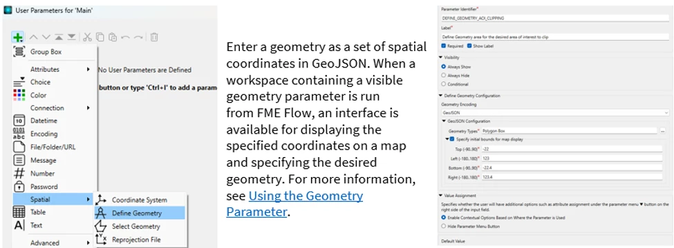
When this parameter type is published to FME Flow and a ‘Workspace App’ is created, under the ‘Parameter Defaults’ there is an option for Map Configuration, as outlined in this helpful article Using the Geometry Parameter – FME Support Center.
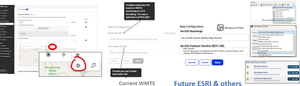
Why add ESRI map support to Flow Apps?
Many organisations already manage authoritative spatial context through Esri platforms. When a Flow App requires a user to draw or select an area of interest, the user often needs to see operational reference layers such as boundaries, tenements, assets, work areas, inspection zones, environmental constraints, or approved operational footprints.
Without access to these layers in the Geometry Picker, users may need to manually cross-reference another GIS application, which can reduce confidence, increase error risk, and make the Flow App feel disconnected from established enterprise GIS workflows.
Desired spatial geometry parameter functionality:
- Support existing Esri webservice/connections already configured and authenticated in Flow to come into the Flow spatial geometry parameter
- Allow Flow App authors to configure Esri REST 1. map and 2. feature services as selectable or reference layers in the Geometry Picker.
- Respect secured services where authentication is already configured in FME Flow, including (arcgis) web connections or stored/encrypted web service credentials
The old htmlreportgenerator supports the consumption of “feature layer URLs”, even multiple layers if they are comma separated.
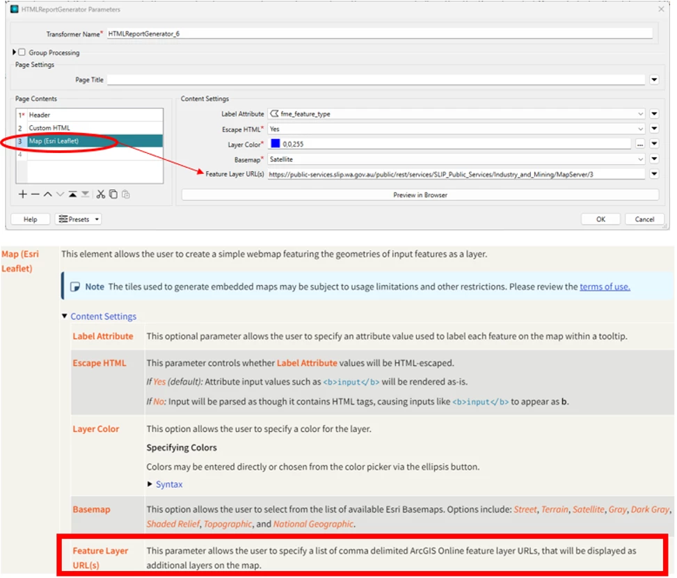
I posted on this in the past, and the community wanted the transformer to see more support added as well. HTMLreportgenerator ESRI leaflet - feature layer URL more info needed | Community
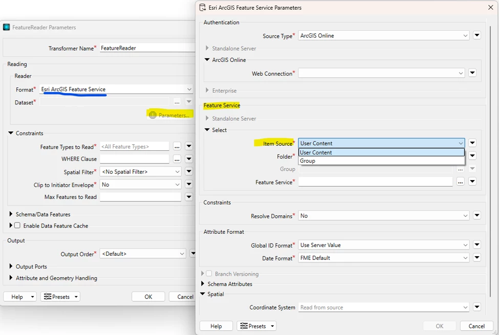
One issue I anticipate might be challenging 😥, is that the latest ARCGISFEATURESERVICE safe.esri.agol package only supports content that is my content or shared to groups. The above functionality all assumes the esri REST map/feature services are shared to groups. But through the use of web connections to arcgis content, supporting group shared or originisational shared content like basemap services could be explored?
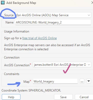
The Background Maps available in FME Form, would be very complimentary if added to FME Flow and Workspace Apps!
Much of the functionality could be used in a similar manner 😎
You might find other ideas similar to this one