In print it is possible to visualize the line created, totally without logic, and in red what would be the appropriate route.
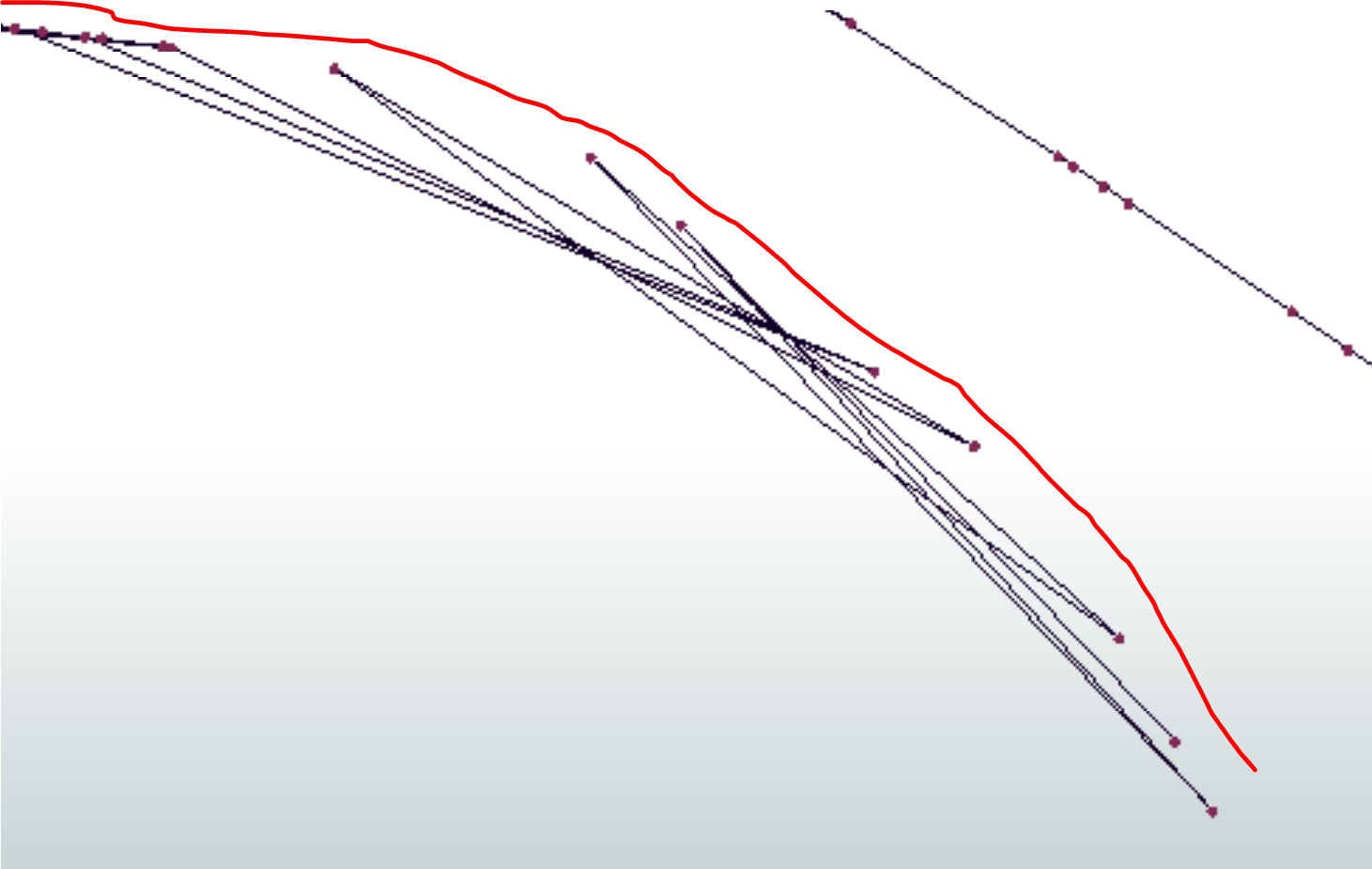

In print it is possible to visualize the line created, totally without logic, and in red what would be the appropriate route.
Best answer by geomancer
In this question there is mention of an algorithm to sort points in a clockwise order relative to a central point. It looks like that algorithm could work for this route (although unfortunately it was not suited for the data from the original question).
No account yet? Create an account
Enter your E-mail address. We'll send you an e-mail with instructions to reset your password.


