Visualising data on inspector map after reprojection
I would like to visualise data on the inspector data or in the graphic view after I reprojected it. That would be in the middle of a workspace before using other transformers and just to locate some features.
I know it’s possible to write the data in a shape and check the features on another software like QGIS or ArcGIS but I would prefer to do that in FME directly if that’s possible, when I’m building my workspace.
Can I do that?
Page 1 / 1
You can simply click the outputport of the Reprojector and choose “Connect Inspector”.
Or, when using FeatureCaching, simply click on the magnifying glass.
I tried but if I look at two datasets together on the map they don’t show up in the same place when they should be. And I just found out that the old projection is set up on the map, so it still shows the previous projection?
Sorry I’m new to FME still.
How I think this works:
If a background map is configured, the background map defines the projection.
If no background map is configured, the first dataset in the inspector defines the projection.
So I suspect one of the sets entering the inspector has a different projection defined than you think. You can see this easily when you select a feature and look in the Feature Information window.
Personally, I work with multiple screens, and I display my data on a different screen than workbench, in the Data Inspector, not the Visual Preview. This is less cramped together in one window with workbench. You can set this under Tools → FME Options → tab Workbench, checkbox Data Inspection, Inspect with Data Inspector when Visual Preview window closed.
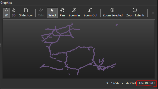
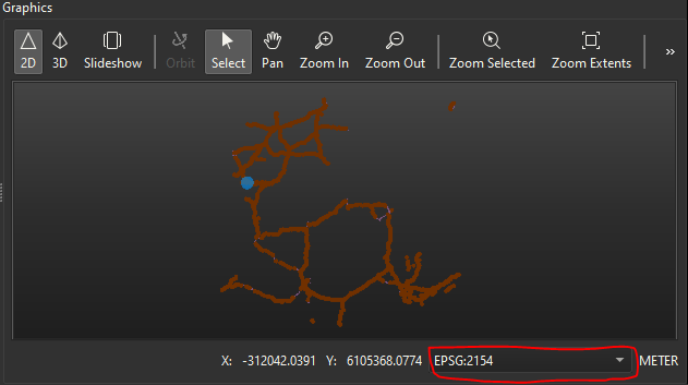
Thanks! I tried adding another layer with a different projection (EPSG:2154) from my data (it was EPSG:4326, I reprojected in EPSG:2154) and I can choose at the bottom which projection I want to look at the data (see photo).
So I think even if I reproject my data with the transformer, it still shows with the original projection at first (the orginal projection is written in the Feature Information window), but I can choose which one I want when viewing in the map. I guess I need to really write the data after reprojection to really “encode” the new projection.
Thanks for the tip about the Data Inspector, this will be helpful!