


Question

Map Extent Issue when Publishing to ArcGIS Online

  • August 18, 2026
  • 6 replies
  • 124 views

chloenev
Contributor
Forum|alt.badge.img+3

Hi everyone,

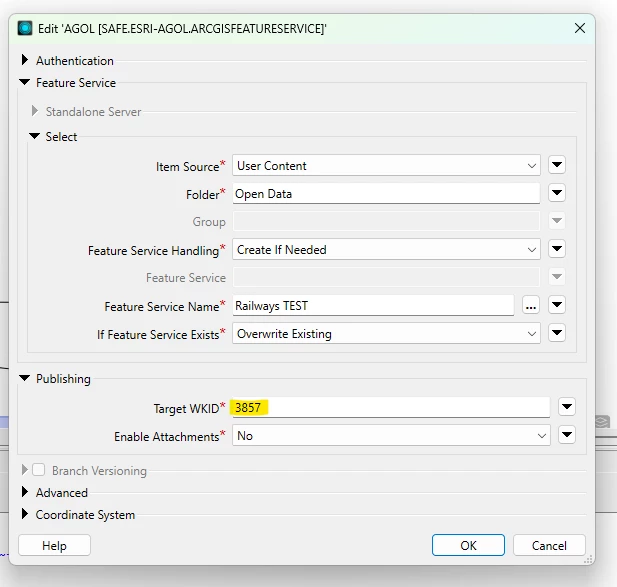
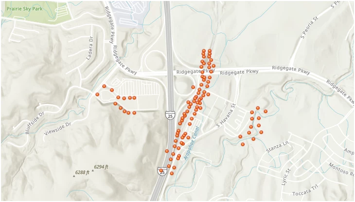
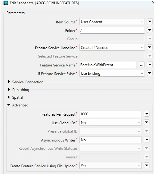
I’m publishing hosted layers to ArcGIS Online (AGOL) using the Esri ArcGIS Feature Service writer. My issue is that the map extent for the item in AGOL is at 0,0 (aka middle of the ocean). I’m not sure what I’m doing wrong to cause this problem. I have attached screenshots below of my workflow and writer settings. 

I reproject the layer to ESPG:3857 as recommended. I have also tried with ESPG:102100 and no luck. 

Workflow to publish to AGOL


Write parameters in Workbench 2025.2

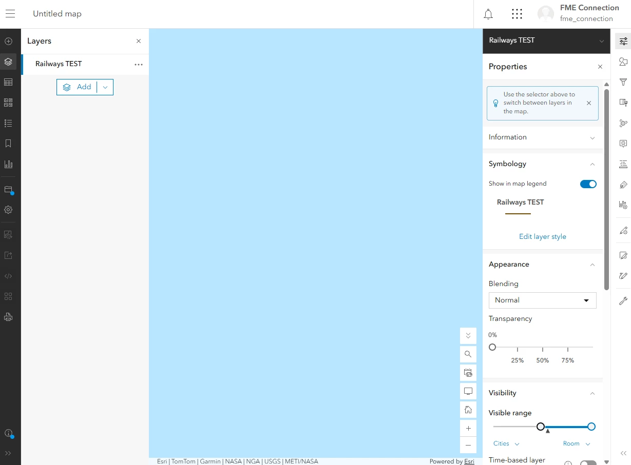
The current map extent in AGOL:


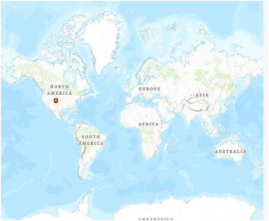
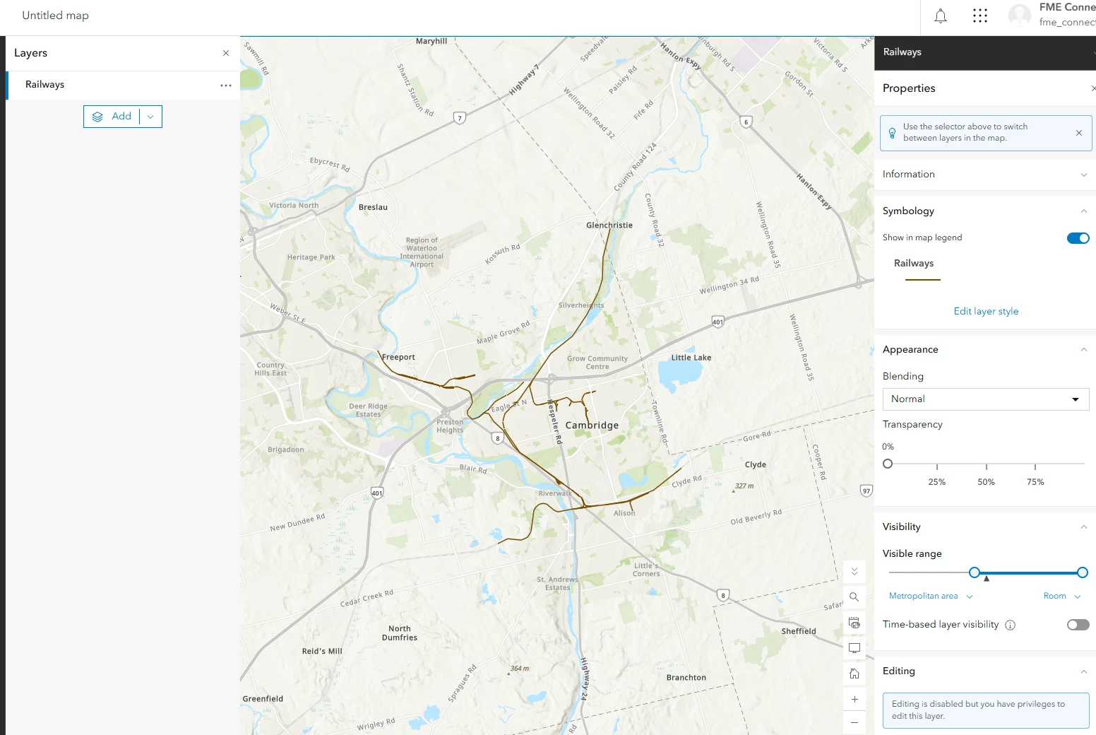
My goal map extent that is zoomed into the layer:
 

6 replies

hkingsbury
Celebrity
Forum|alt.badge.img+73
  • Celebrity
  • August 23, 2026

The extent is set by the Map, not the data (Feature Service published by FME)

To set the default extent in the map navigate to where you what the map to load and save it: Solved: Update Default Map View, New Map Viewer - Esri Community


chloenev
Contributor
Forum|alt.badge.img+3
  • Author
  • Contributor
  • August 24, 2026

The extent is set by the Map, not the data (Feature Service published by FME)

To set the default extent in the map navigate to where you what the map to load and save it: Solved: Update Default Map View, New Map Viewer - Esri Community

I did already set the extent within AGOL, but I was hoping it was an option to automate since I have a number of layers to publish/update. Thanks for your reply! 


becchr
Influencer
Forum|alt.badge.img+35
  • Influencer
  • August 24, 2026

The extent is set by the Map, not the data (Feature Service published by FME)

To set the default extent in the map navigate to where you what the map to load and save it: Solved: Update Default Map View, New Map Viewer - Esri Community

I did already set the extent within AGOL, but I was hoping it was an option to automate since I have a number of layers to publish/update. Thanks for your reply! 

You could set the extent with an API-call after you publish it?

https://developers.arcgis.com/rest/users-groups-and-items/update-item/#:~:text=States%20and%20Canada-,extent,-The%20bounding%20rectangle


chloenev
Contributor
Forum|alt.badge.img+3
  • Author
  • Contributor
  • August 24, 2026

The extent is set by the Map, not the data (Feature Service published by FME)

To set the default extent in the map navigate to where you what the map to load and save it: Solved: Update Default Map View, New Map Viewer - Esri Community

I did already set the extent within AGOL, but I was hoping it was an option to automate since I have a number of layers to publish/update. Thanks for your reply! 

You could set the extent with an API-call after you publish it?

https://developers.arcgis.com/rest/users-groups-and-items/update-item/#:~:text=States%20and%20Canada-,extent,-The%20bounding%20rectangle

So I did try the ArcGISOnlineConnector transformer with the Set Details action > Update Field Extent and that works as well. Only thing is I don’t believe you can batch run it, so again I was setting it individually for my 20+ layers. But it’s not the end of the world as I just need to set it once. I will look into the link you shared, thank you! 


salvaleonrp
Enthusiast
Forum|alt.badge.img+22
  • Enthusiast
  • August 24, 2026

Documentation states that you can change Target WKID to a local CRS, changing it to local will not change the initial extent of your data, keep your TargetWKID to 102100 or 4326 whichever unit is applicable to your data:

  • 102100 → ±20037508 / ±20048966 (meters)
  • 4326 → -180, -90, 180, 90 (degrees)

I have a very similar workflow as yours and I actually repro’d your extent in Null island when I changed my TargetWKID to 2232 (Colorado Central). In my case, the data is still in Colorado but the default extent is null island. Its a weird behavior the data is projected but the initial extent is scaled to null island ….. after more tweaks, I concluded that using Coord Ref System configuration will not solve the extent. 

So I went back to the original problem that I wanted to solve. I got two solutions neither one I really want to pursue but it works for now.

ORIGINAL PROBLEM: Correct location with the world boundary as my extent


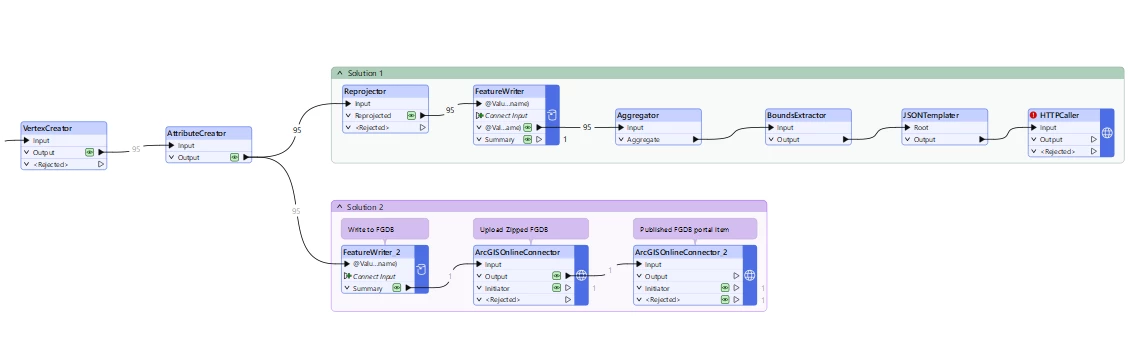
Solution1: Use the ESRI ArcGIS feature service writer and accept the default results of using Web Mercator, picture above. Then apply either options of the workaround below.

option 1: fix in the Settings of the feature service UI of AGOL. Solution provided by ​@hkingsbury.

option 2: Use a FeatureWriter for your AGOL Feature Writer, add an AGGREGATOR, BOUNDSEXTRACTOR and JSONTEMPLATER to build {"extent":{"xmin":…,"ymin":…,"xmax":…,"ymax":…,"spatialReference":{"wkid":…}}} add an HTTPCaller on the UpdateDefinition endpoint of the feature service to change its Full extent value. 

This will change the Full extent property of the feature service.


Solution 2: Use the ARCGISONLINE Connector transformer writing my output first to a file GDB. The FGDB creation will create the feature class with the initial extent from the min XY max XY of the data.

Solution2 is my choice and a much shorter, repeatable solution without hardcoding atribute values but then I have to consider the nuances of having a feature service published from a online FGDB. You can use the FGDB for your update feature service workflow or unlink them.

Below is a screenshot of my two solutions on the canvas.

I hope there’s a better and shorter solution that others may have, but I did resolve my issue.


salvaleonrp
Enthusiast
Forum|alt.badge.img+22
  • Enthusiast
  • August 25, 2026

I found an easier solution… but unfortunately you have to revert back to the legacy format writers….I used the ARCGISOnline Feature Service format writer.

Set the Create Feature Service Using File Upload to Yes. It deleted the zipped FGDB after the service has been published.

I submitted this idea to add the setting to the current format writer.