Hello everyone,


I have a set of polygons that I would like to chop into a grid, create points on each corner, and create an id for each point starting from the southwest corner of each 12x12 area. Each polygon gets divided into a 12 x 12 grid and the corner points of the grid would be something like PolygonA_0,0 at the southwest corner 0,2 0,2...0,12 all the way up to PolygonA_12,12 in the northeast corner. This would be the same for each larger polygon. It woul be just like a point grid created by the 2dGridCreator.


So far I've use the Tiler to divide the polygons into the 12x12 grid and a TopologyBuilder to get the nodes, but I am a little stumped on how to get the IDs for the nodes.


Does anyone have an idea on how to get these iIDs populated?


Thank You


Justin
Hi Justin,


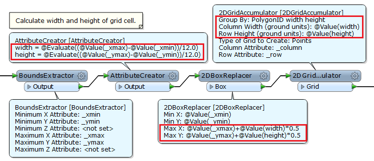
This workflow might help you.


Then, you can create required attribute based on "_column" and "_row".


Hope this helps.


Takashi
You can redirect the extracted nodes and gridlines to antother topologybuilder
actually it is even easier if u just


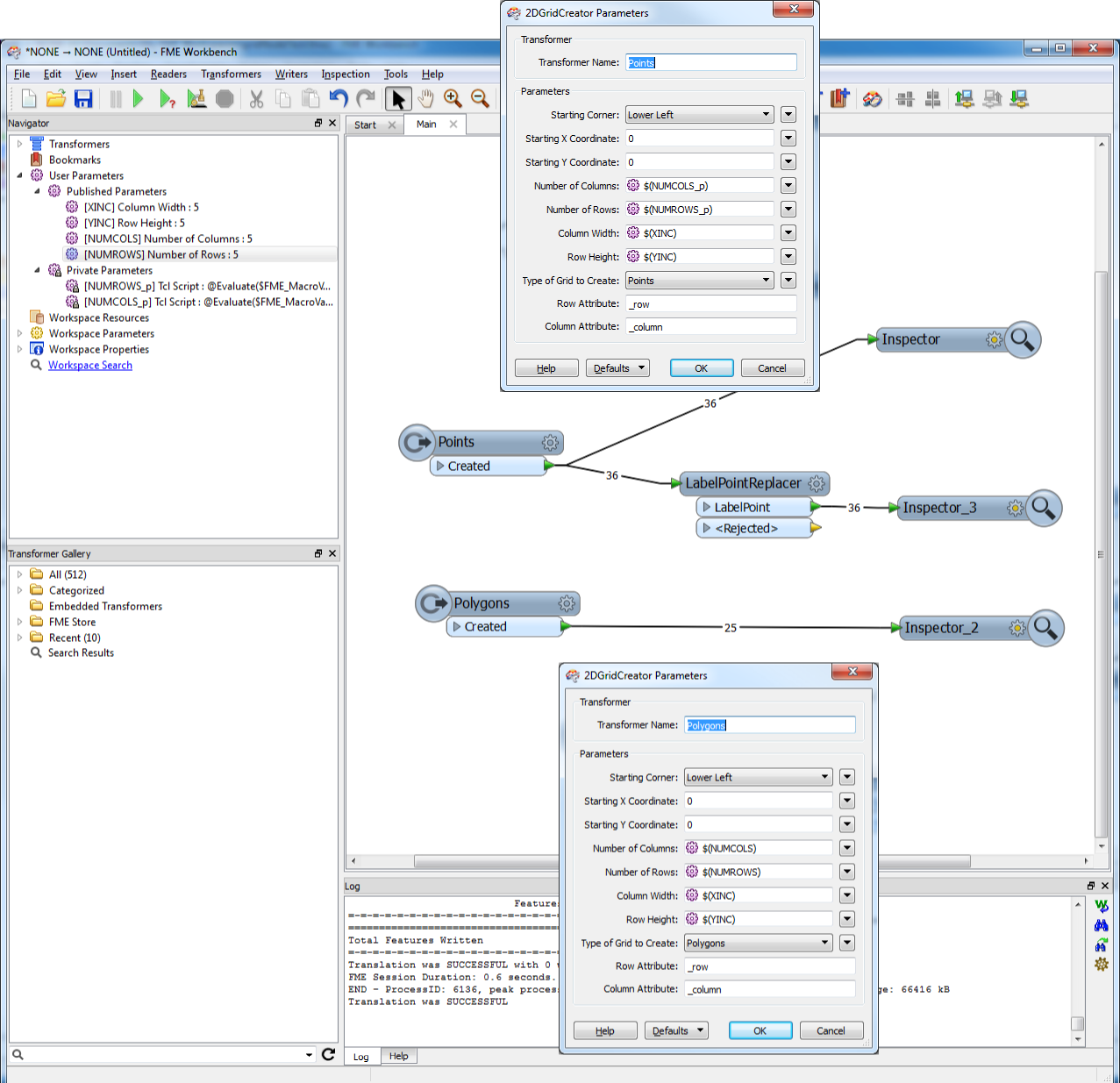
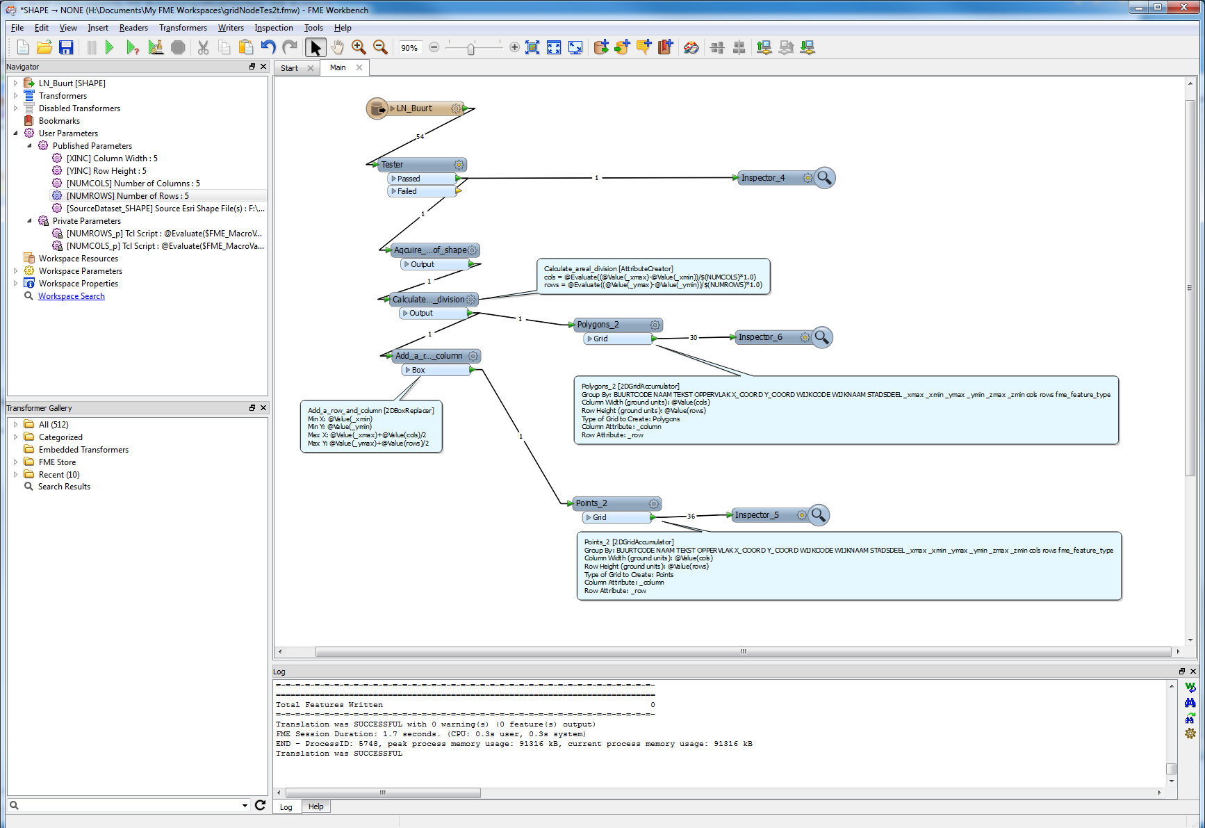
 use 2 gridcreators or accumulators. One creates grid of points, the other polygons.


With same settings ther row/column values match.


Soutwest would have start (_xmin,_ymax) from the total BoundsExtracted.
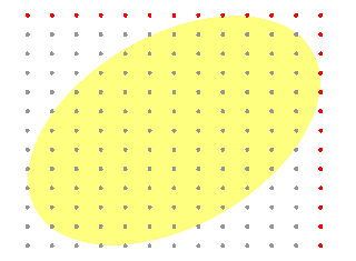
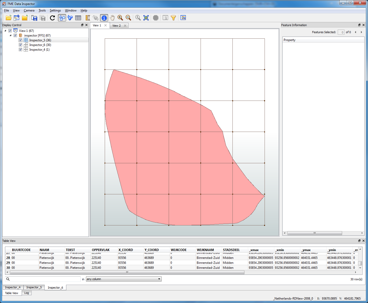
I'm afraid that you might miss how to get the points on north/east edges of the bounding box. The red points in this image.


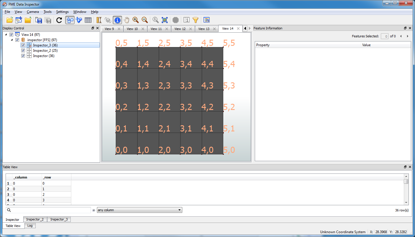
not realy, u just have to take into acount that u need a +1 on column and row.
To illustrate this...


adn for a 2DGridAccumulator..


still hav'nt got rid of top row...
I was able to get results using your workflow Takashi. This creates the points with IDs that closely match the tiled polygon. They don't match exactly because they were created with a bounding box. I then use the AnchoredSnapper to get them to the correct position. It isn't ideal since it relies on snapping but it seems to work.


Gio I haven't yet had time to fully explore your solution. What I am trying to do is divide up townships into quarter sections and give the corners ID's so I have to cut up an existing polygon. I'll have to see if I can get this to work with your suggestion.


Thank you both for your help,


Justin
Thats what my solutions do.


Zoom in to see settings.


I set it up in 5-10 mins both versions.


You dont have to cut polygon up if u don't want/need to, to create the grid and its cornerpoints.


My example uses a neighbooorhood, called a "buurt" in Dutch btw.

Reply