
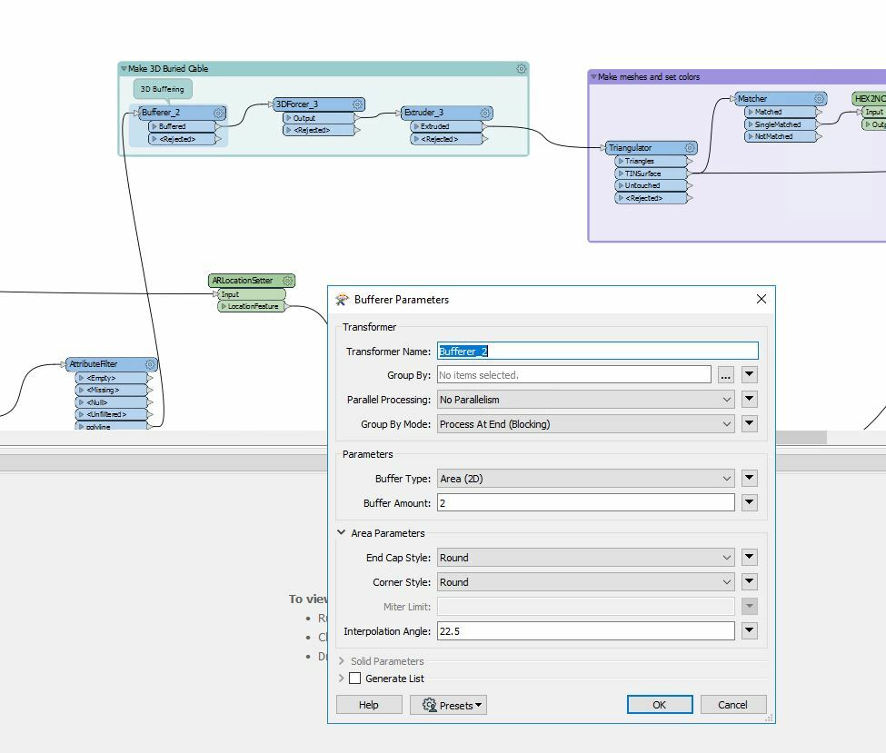
Hello everyone! My company is looking into utilizing SAFE's Augmented Reality tools! We are currently testing the application and are working on becoming familiar with the process at hand. I am attempting to create a "mock" workflow using Mr. Dmitri Bagh's 'City of Coaquitlam' model as my basis. I created a small google document that will show a single buried cable that I generated in ArcMap. However, I keep failing at the end of the workflow. Making it to the 'bufferer' tool before the 3D forcer and extruder. We will want to look at larger datasets in the future, and I figured this workflow may be the best to accommodate. I have generated smaller AR models with using the methods found in the '3D Buffered Pipeline' examples. But struggle to generate large scale systems. In that workflow, I am also unable to anchor the gas pipe sample, and scale to an appropriate size/show at ground level.
I will attach my workspaces. Would anyone have any tips or tricks for me? I am getting pretty discouraged with my inability to correctly project these models.
 Thank you for taking the time out to help me. The prospect is exciting...I just need to get on the right track... :)

")

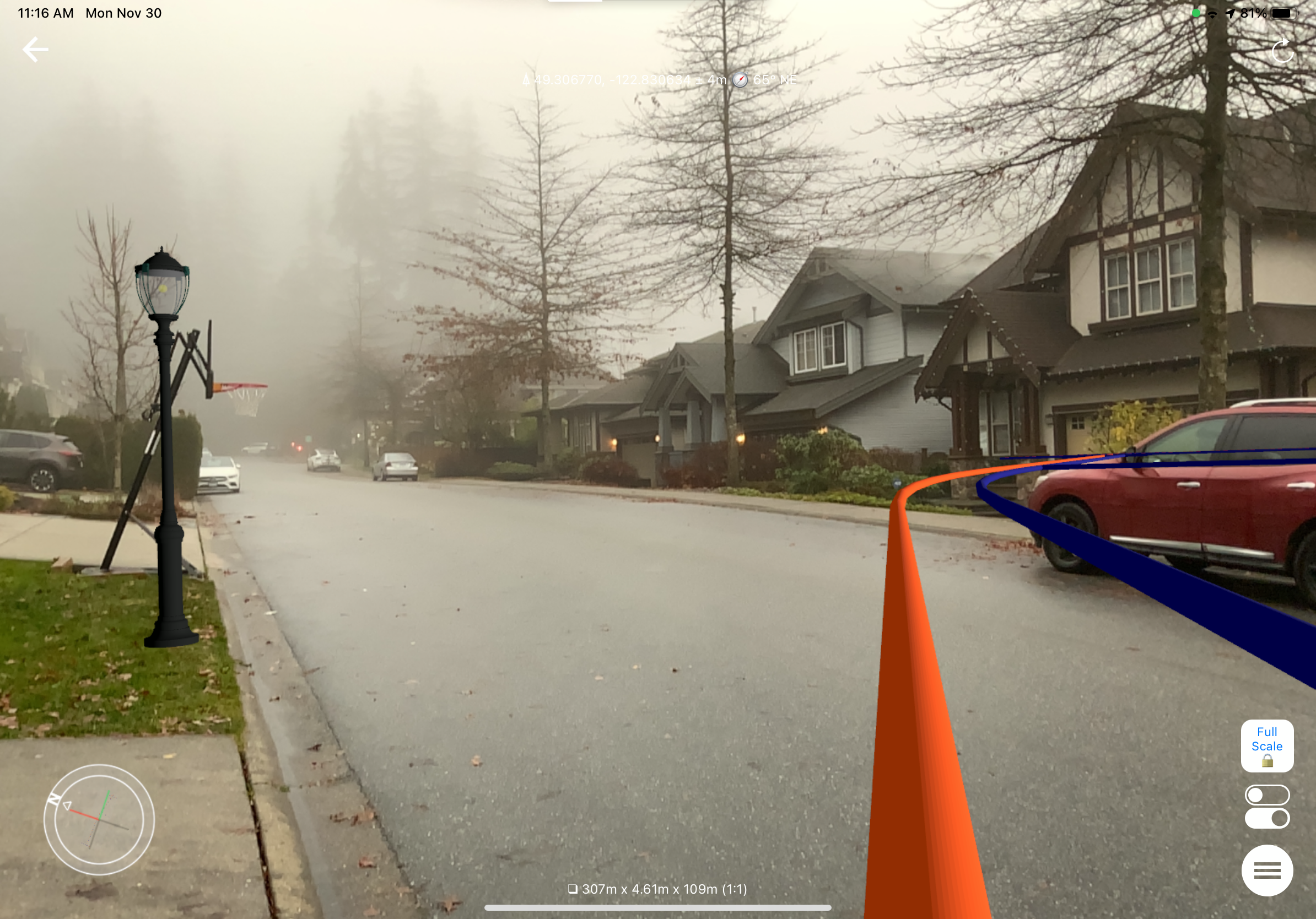 Maybe a couple more things - try making a smaller model - 300 meters might be too much for things that should represent something relatively thin and long. It is hard to adjust the location of a model with such extents - models can behave quite unexpectedly - a tiny movement of a finger on a screen can cause a big jump on the ground. Try up 100 meters or even less.