I have eight lines going into a snipper that are identical with the exception of a distance attribute. I am trying to trim these lines to the length specified in the distance attribute. Two of the lines trim correctly and the other six trim to "0" length and exit as a point. The min and max extents coming in appear to be correct but the min and max extents of the output show the six points being the same. I have reviewed this question from the past: snipper point in exit (https://community.safe.com/s/question/0D54Q000080hdg9SAA) but didn't find my answer there.

Here is a snippet of my workspace. CCTV
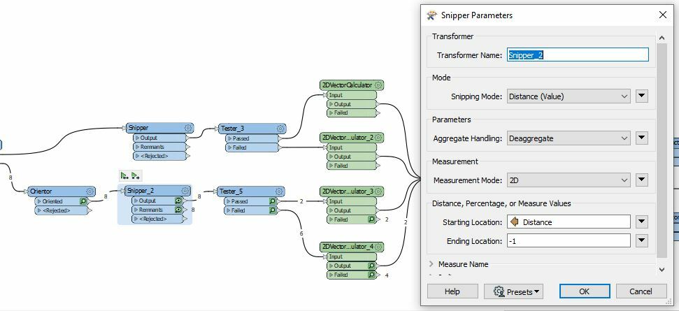
@jimq66​  Snipper returns a point if the start / end points are of the end of the line. It's likely the -1 as the End Location that is confusing things. If you can attach the sample dataset then we can probably see what the root cause is.


@Mark Stoakes​  There are two workspaces in the attached file. The real workspace is looking at SDE versioned GIS data to determine if service laterals exist. The workspace looks at the inspections data to see if taps (service laterals) exist. Then looks at SDE to see if taps exist. I am trying to get it to compare a count of inspection taps to a count of SDE taps and either pass or fail. It it passes (both counts match) then nothing is written. If the count is different then it writes to FGDB. If they don't exist in SDE then they are written to FGDB. Sewer Taps v2 reads and writes to shapefiles where I cannot duplicate the error. Sewer Taps v3 reads and writes file geodatabase records and duplicates the error. In my real workspace I read SDE versioned data and file geodatabase data (same as writer) and write file geodatabase data. The erro occurs between the Orientor and Snipper. Hope this makes sense.


@Mark Stoakes​  There are two workspaces in the attached file. The real workspace is looking at SDE versioned GIS data to determine if service laterals exist. The workspace looks at the inspections data to see if taps (service laterals) exist. Then looks at SDE to see if taps exist. I am trying to get it to compare a count of inspection taps to a count of SDE taps and either pass or fail. It it passes (both counts match) then nothing is written. If the count is different then it writes to FGDB. If they don't exist in SDE then they are written to FGDB. Sewer Taps v2 reads and writes to shapefiles where I cannot duplicate the error. Sewer Taps v3 reads and writes file geodatabase records and duplicates the error. In my real workspace I read SDE versioned data and file geodatabase data (same as writer) and write file geodatabase data. The erro occurs between the Orientor and Snipper. Hope this makes sense.

@jimq66​  thanks for sending along the workspaces & data.

I can't reproduce the issue of Snipper creating points with your workspace. But my guess would be it's related to the -1 for the ending location. It looks like you're trying to use a mixture of distance (Distance) and index (-1 to represent the last vertex). I think this is a bug and I wouldn't rely on this behaviour. I think using LengthCalculator to calculate the line length and use that as the end length would be safest.


Reply