Question

Surface Modeller "minimum number of points"

  • February 25, 2019
  • 2 replies
  • 83 views

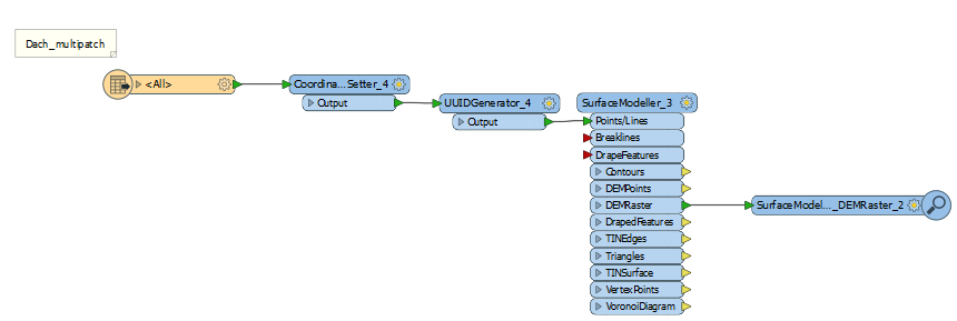
I want to create a DEM from Multipatch-geometry contained in a geodatabase, for doing that I thought using the surface modeller could work, where in surface modeller I group the points by the UUID generated attribute:

0684Q00000ArElBQAV.png

But the errors are

"The specified cell size of '2' units in the y axis is invalid. Cell size must be less than raster extents"
"Surface Model cannot be constructed. Either all points are linear or initial set of points did not consist of 3 non NAN elevations"

For the first error I think it's due to objects with 3 points in less than a diameter of 2 meters

Second error is due to objects with less than 3 points

Questions: 

1) how could I exclude/drop/ignore geometries with less than 3 points ?

2)how could I still add a cell value to objects less than 2 m ?

2 replies

gio
Contributor
Forum|alt.badge.img+15
  • Contributor
  • February 25, 2019

@raphaelvallat11

If you group the points by a unique identifier then you are actually trying to build surfaces with a single point. (each is a group of 1)

(Unless they were aggregates prior to assigning a UI.)


Of course this causes the second error message, as unit 2 is larger then 0.


You need to check why you are Grouping in the Surface Modeller. As far as I can see there is no reason for it in your example, as you seem to be grouping objects to single object groups.


gio wrote:

@raphaelvallat11

If you group the points by a unique identifier then you are actually trying to build surfaces with a single point. (each is a group of 1)

(Unless they were aggregates prior to assigning a UI.)


Of course this causes the second error message, as unit 2 is larger then 0.


You need to check why you are Grouping in the Surface Modeller. As far as I can see there is no reason for it in your example, as you seem to be grouping objects to single object groups.


@gio Thank you. The geometry of the input is multipatch, I m not familiar with it and may not be understanding it correctly. I think but I'm not sure that every multipatch feature has a unique ID (in my case every building), and all points (vertices) of each feature are grouped by one ID in the UUID generator. I tried without the UUID generator, and the problem is that it does interpolate a DEM in between buldings, where I actually want NoData. And one raster per building, which I would later merge in a mosaicker. Any thoughts on my reasoning ? or it could work


Reply


Cookie policy

We use cookies to enhance and personalize your experience. If you accept you agree to our full cookie policy. Learn more about our cookies.

 
Cookie settings