Hello, my previous post was not well Described apparently,
i need to split .las just like that. please if you suggest any workflow do describe it a little more than just the name of transformer as that is usless for me (i dont really know how to use FME)
Best answer by hkingsbury
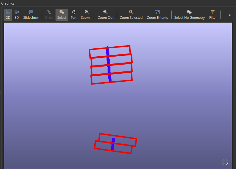
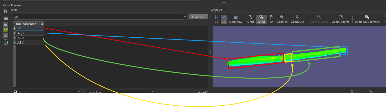
I’ve attached a workspace (2024.1) that will split the input LAS into a number of areas (using the iterate snipper) then generate some clipping areas and then clip the LAS to those areas.
This is assuming that your LAS is following a linear area such as a road or rail corridor
This post is closed to further activity.
It may be an old question, an answered question, an implemented idea, or a notification-only post.
Please check post dates before relying on any information in a question or answer.
For follow-up or related questions, please post a new question or idea.
If there is a genuine update to be made, please contact us and request that the post is reopened.
I’ve attached a workspace (2024.1) that will split the input LAS into a number of areas (using the iterate snipper) then generate some clipping areas and then clip the LAS to those areas.
This is assuming that your LAS is following a linear area such as a road or rail corridor
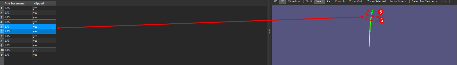
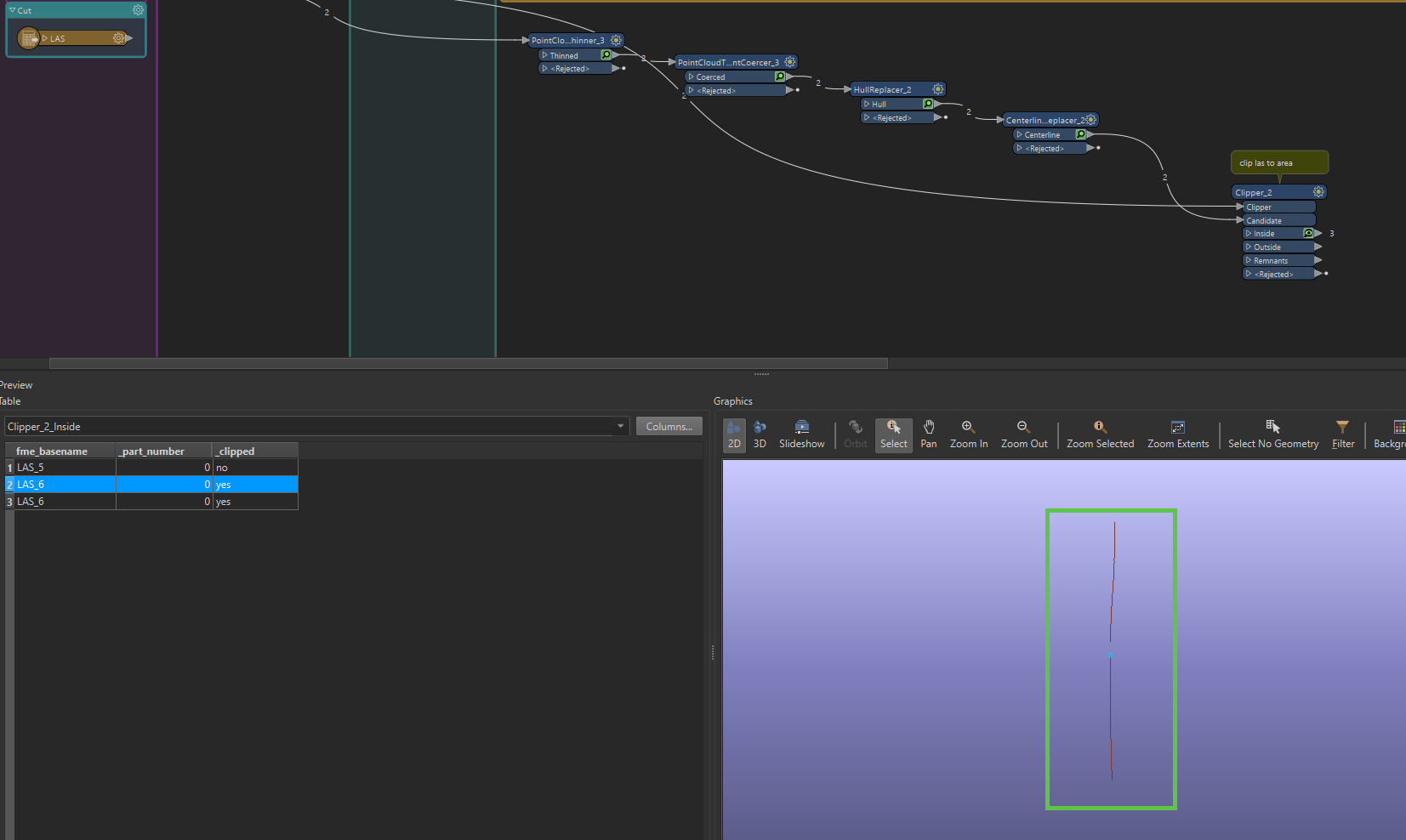
if you could help me further i have a question about updating the segments that come from the resoult of that split.
What i mean:
i want to take these 2 as example
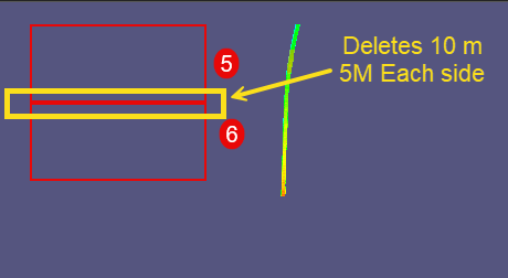
and make a Break zone that is ca 10m, in that zone everything must be deleted.
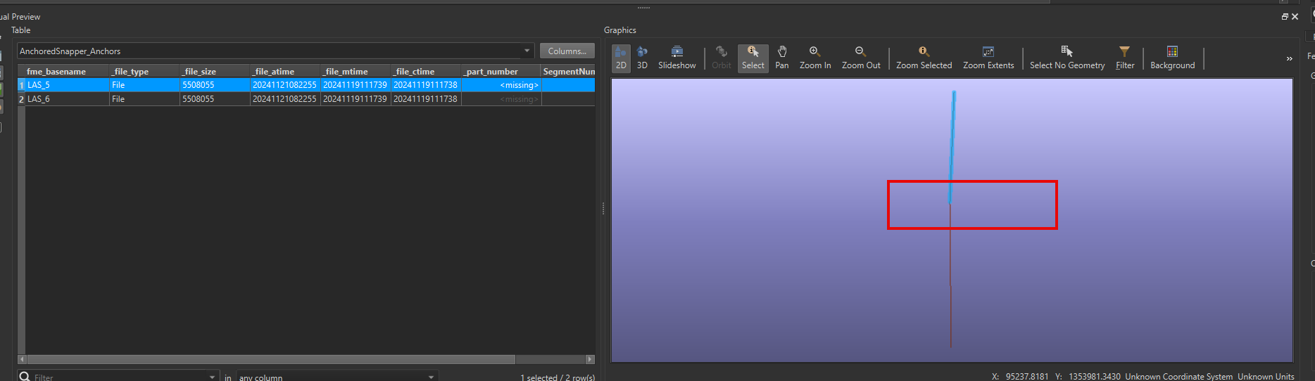
than insert them back in with a new file
To Summerise:
Imagine a tunnel or an area that is initially scanned. Over time, the area undergoes changes and needs to be rescanned. However, the focus is solely on identifying and capturing the newly changed parts.
if there is a better way of doing it im happy to hear your take on it.
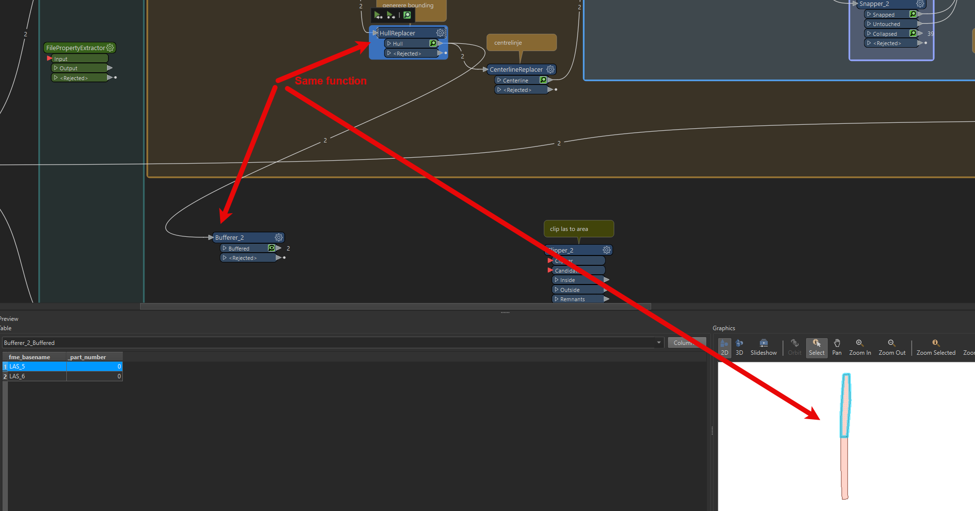
I would assume you have an asset dataset that defines where the tunnel is. Using that, buffer the tunnel (turn off end caps) and use the resulting polygon to clip out the old data. Clip the new data to ensure you have that in same extent then combine the new data into the old.
OR
if you have the new data, generate the bounds of the data (use the first part of the workbench I initially shared) then use that to clip out the old data and then combine the two data sets
You need to then buffer them to create the polygons for the clipper. Make sure you set End Cap Style to None.
From your screenshot its not clear if you’re doing this on the new data. You want to be doing this step on the new data to insert into the existing data. This will create a polygon to clip the extent of the new data out of the old data, therefore removing any overlaps
Hypothetically, you have an existing scan of a rail corridor, that corridor passes through a tunnel. The tunnel has been re-scanned recently and you want to remove the old tunnel data and replace it with the new scan.
The original workbench has logic in then that will generate a rough centreline for that scan. To remove the old tunnel data you need to buffer that centreline to generate an area that can be used as a clipper. The hull replacer output could be used, but you’ll likely also need to buffer that.
Now that you have an area that covers the bound of your new tunnel scan you can use that to clip out the tunnel data from the existing scan of the corridor.
Next, you can use the pointcloudcombiner to combine the new tunnel scan with the rest of the scan for the corridor