


Question

Rivers and weirs network analysis

  • August 18, 2026
  • 2 replies
  • 13 views

fme_flo
Forum|alt.badge.img+1

I want to calculate upstream and downstream distances along river polylines between barrier points.


I’ve got as far as generating a topologically correct river network divided at barrier locations, river intersections and junctions complete with network_id.


I’m stuck on the next steps! The main challenge is what to do upstream when a river branches out.


Any help would be greatly appreciated!
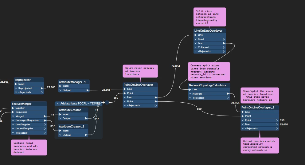
 

Process so far


2 replies

vadis
Contributor
Forum|alt.badge.img+10
  • Contributor
  • August 18, 2026

Hej!
It would be helpful with some more visual context and at which exact places you are struggling to achieve your task. I think you are on a good path to establish the principle, though! Just make sure you check linear integrity of dataset for topological breaks/faults before splits and ID setting for analysis.


fme_flo
Forum|alt.badge.img+1
  • Author
  • August 18, 2026

Hej :) ​@vadis 

Basically I am not sure what the next step is to calculate the distances between barriers up and down stream! I need a way of grouping together river sections between barrier points and calculating the total length. I want to include the total length of river between barriers, even where the river divides.

I think my process so far is successful in ensuring the network dataset is clean for analysis…!