Question

Read PDOK WMS service

  • May 21, 2019
  • 13 replies
  • 137 views

redgeographics
Celebrity
Forum|alt.badge.img+60

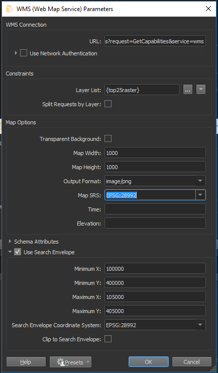
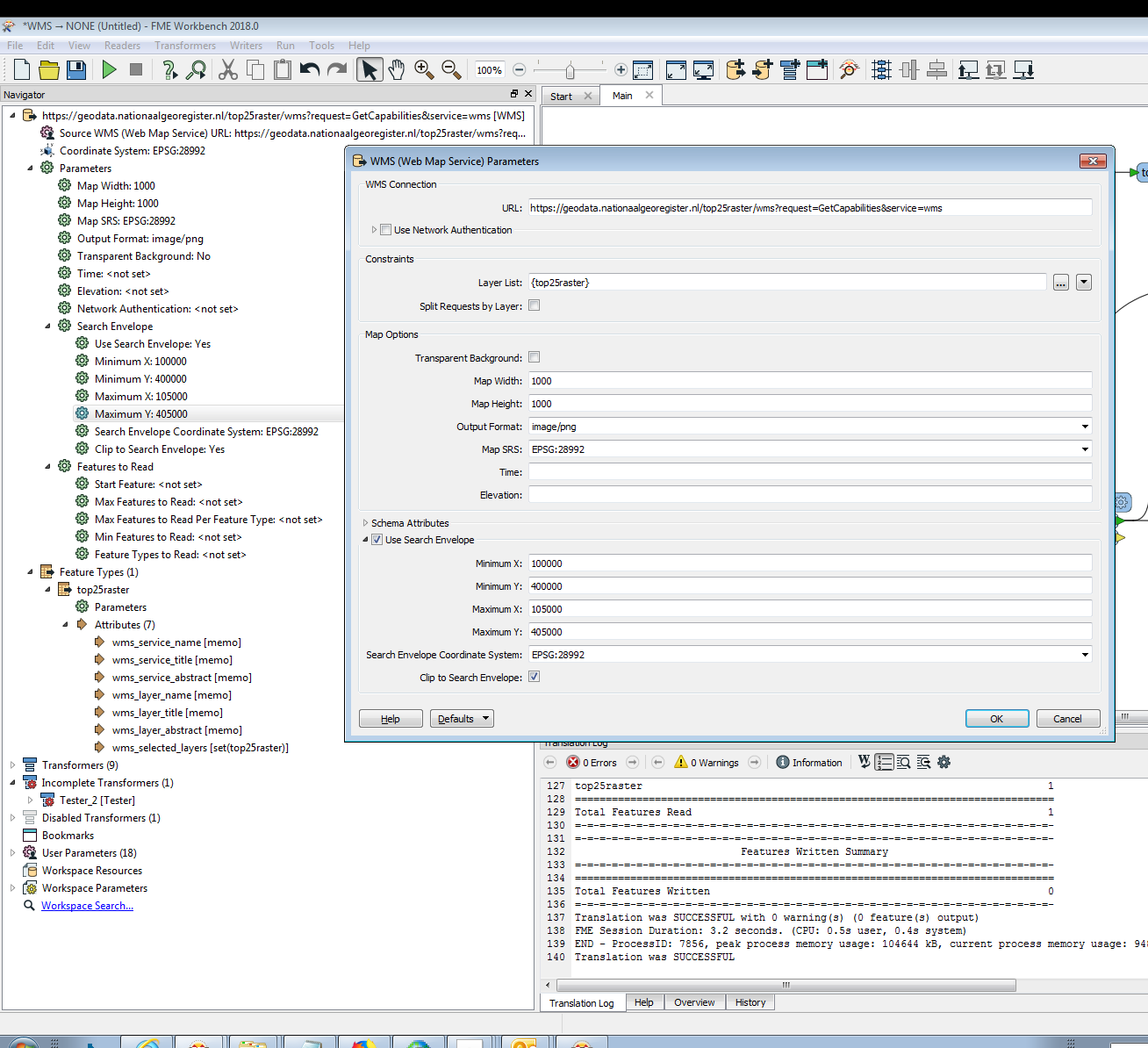
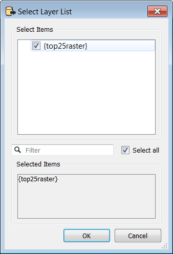
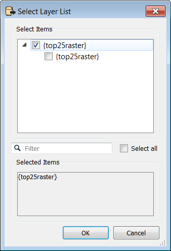
I am trying to read data from a PDOK (Dutch open data portal) WMS service but having a hard time. If anybody wants to try, it's this one: https://geodata.nationaalgeoregister.nl/top25raster/wms?request=GetCapabilities&service=wms (but others from the same service have similar issues).

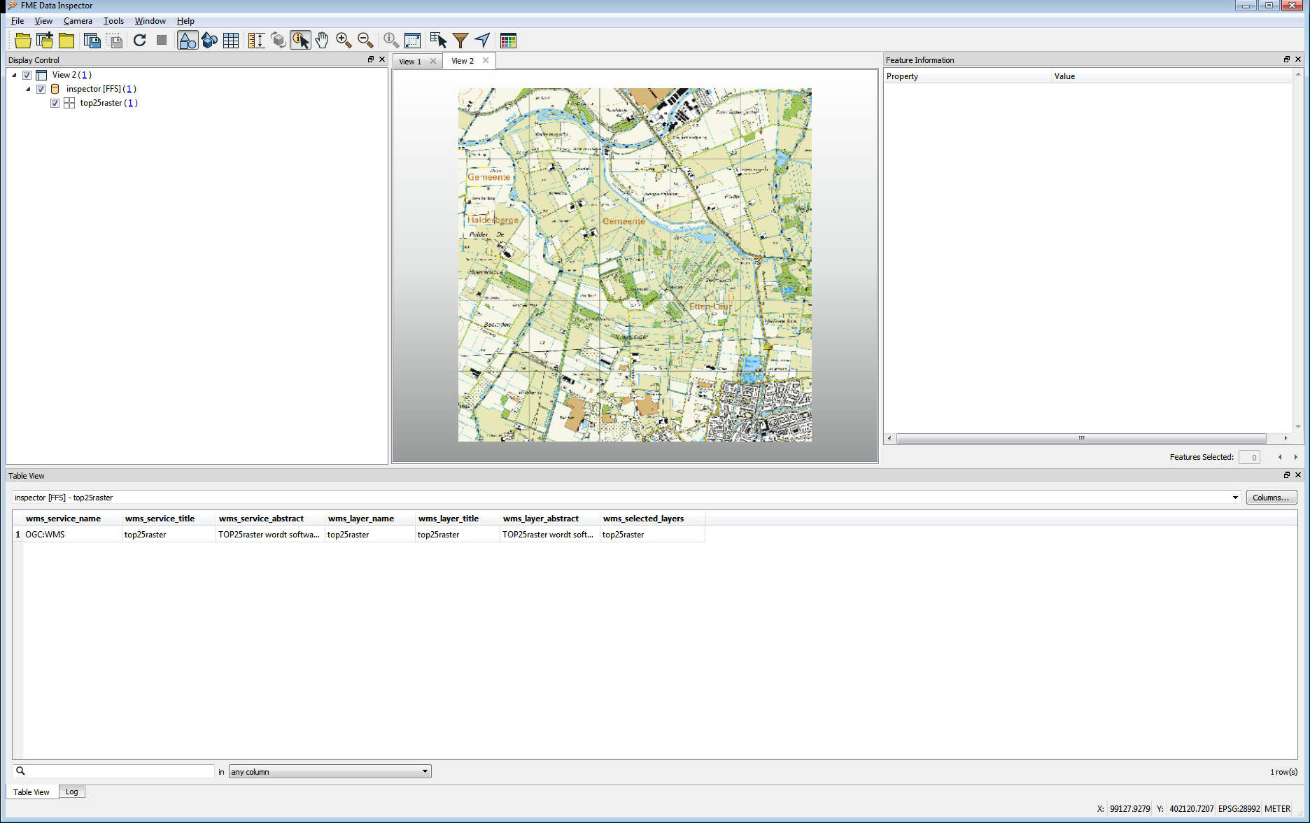
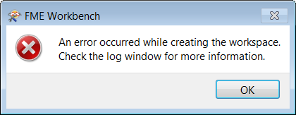
I'm using FME 2019, but 2018 shows the same issue, it also doesn't matter whether I use a WMS reader or a FeatureReader. I'm not getting any useful errors, but other software (Global Mapper) has no problem reading the service.


This post is closed to further activity.
It may be an old question, an answered question, an implemented idea, or a notification-only post.
Please check post dates before relying on any information in a question or answer.
For follow-up or related questions, please post a new question or idea.
If there is a genuine update to be made, please contact us and request that the post is reopened.

13 replies

oscard
Influencer
Forum|alt.badge.img+22
  • Influencer
  • 344 replies
  • May 21, 2019

Could you share how you have set the WMS parameters? I have tried reading it with FME 2019, but nothing. It's weird.


redgeographics
Celebrity
Forum|alt.badge.img+60
  • Author
  • Celebrity
  • 3701 replies
  • May 21, 2019

Could you share how you have set the WMS parameters? I have tried reading it with FME 2019, but nothing. It's weird.

This should be a reasonable set of parameters:


oscard
Influencer
Forum|alt.badge.img+22
  • Influencer
  • 344 replies
  • May 21, 2019

This should be a reasonable set of parameters:

I have also tried to add it as Background in the Data Inspector. It doesn't add the name layer to the GetMap request.


nathanatsafe
Safer
Forum|alt.badge.img+9
  • Safer
  • 284 replies
  • May 24, 2019

Hi @redgeographics,


No luck for me either. Can you send a screenshot of what the layer looks like in Global Mapper? Can you identify any differences in the parameters or the way in which Global Mapper accesses the service? I tried various parameter configurations in QGIS as well but couldn't get any data. In the metadata the service information says "couldn't identify image format". Bizarre.


Best,


Nathan

nielsgerrits
VIP
Forum|alt.badge.img+60
  • 2939 replies
  • May 27, 2019

Hi @redgeographics,


No luck for me either. Can you send a screenshot of what the layer looks like in Global Mapper? Can you identify any differences in the parameters or the way in which Global Mapper accesses the service? I tried various parameter configurations in QGIS as well but couldn't get any data. In the metadata the service information says "couldn't identify image format". Bizarre.


Best,


Nathan

It does work in QGIS but only at the scale range 1:50.000 to 1:6.000.

QGIS 3.6 project attached. QGIS36_Top25Raster.zip


gio
Contributor
Forum|alt.badge.img+15
  • Contributor
  • 2252 replies
  • May 27, 2019

@redgeographics


Hi Red,


I tried it and it works fine.


I have the same settings as you, apart from setting the clip envelope (which I did).

I also set the CoordSys in the navigator, but that's mandatory anyway (else you get a error message).


I used 2018 version btw.


gio
Contributor
Forum|alt.badge.img+15
  • Contributor
  • 2252 replies
  • May 27, 2019

here is a screen of its settings.


redgeographics
Celebrity
Forum|alt.badge.img+60
  • Author
  • Celebrity
  • 3701 replies
  • May 28, 2019

@redgeographics


Hi Red,


I tried it and it works fine.


I have the same settings as you, apart from setting the clip envelope (which I did).

I also set the CoordSys in the navigator, but that's mandatory anyway (else you get a error message).


I used 2018 version btw.

Thanks! Really strange because I'm doing the exact same thing in FME 2018 / Windows (build 18590) and 2019 / Mac (build 19238) and I'm getting errors all the time. There's no proxy working against me (I even tested on different networks)


nielsgerrits
VIP
Forum|alt.badge.img+60
  • 2939 replies
  • May 28, 2019

Thanks! Really strange because I'm doing the exact same thing in FME 2018 / Windows (build 18590) and 2019 / Mac (build 19238) and I'm getting errors all the time. There's no proxy working against me (I even tested on different networks)

I tested as well using 2018.1.1.2 and 2019.0.0.0 and 2019.0.1.0 with these settings and had no succes. I always get this error:

0684Q00000ArN7wQAF.png

And the log only reports:

2019-05-28 09:36:49|   0.1|  0.1|INFORM|Creating reader for format: WMS (Web Map Service)
2019-05-28 09:36:49|   0.1|  0.0|INFORM|Trying to find a DYNAMIC plugin for reader named `WMS'
2019-05-28 09:36:49|   0.1|  0.0|INFORM|Loaded module 'WMS' from file 'D:\apps\fme_2019_0_1_64\plugins/WMS.dll'
2019-05-28 09:36:49|   0.1|  0.0|INFORM|FME API version of module 'WMS' matches current internal version (3.8 20181030)
2019-05-28 09:36:49|   0.1|  0.0|INFORM|<WMS> Capabilities URL: `https://geodata.nationaalgeoregister.nl:443/top25raster/wms?SERVICE=WMS&REQUEST=GetCapabilities&VERSION=1.1.1'.
2019-05-28 09:36:49|   0.1|  0.0|INFORM|HTTP/FTP Transfer: Downloading resource 'https://geodata.nationaalgeoregister.nl:443/top25raster/wms?SERVICE=WMS&REQUEST=GetCapabilities&VERSION=1.1.1' to local file 'D:\tmp\FME_TEMP\WMSCapability_1559029009516_11260.xml'
2019-05-28 09:36:49|   0.1|  0.0|INFORM|HTTP transfer summary - status code: 200, download size: '7443 bytes', DNS lookup time: '1e-6 seconds', total transfer time: '0.093 seconds', url: 'https://geodata.nationaalgeoregister.nl:443/top25raster/wms?SERVICE=WMS&REQUEST=GetCapabilities&VERSION=1.1.1'
Error running translation.
Workspace generation failed.  Parameter file was D:\tmp\FME_TEMP\FME_1559029008993_11904.

jkr_wrk
Influencer
Forum|alt.badge.img+35
  • 424 replies
  • May 28, 2019

Attached workbench reading wms.fmw works on 2017.1.2.1 (gives single white tile of area). But when opening in 2019.0.0.1 or 2018.1.1.2 and editing settings FME closes without notice. When running without edit it gives this error:


2019-05-28 10:54:37|   0.4|  0.0|ERROR |<WMS> Exception detected for the GetMap operation, requested Content-Type, 'image/png', returned Content-Type, 'application/vnd.ogc.se_xml'.
2019-05-28 10:54:37|   0.4|  0.0|ERROR |<?xml version="1.0"?>
2019-05-28 10:54:37|   0.4|  0.0|ERROR |<!DOCTYPE ServiceExceptionReport SYSTEM "http://schemas.opengis.net/wms/1.1.1/exception_1_1_1.dtd">
2019-05-28 10:54:37|   0.4|  0.0|ERROR |<ServiceExceptionReport version="1.1.1">
2019-05-28 10:54:37|   0.4|  0.0|ERROR |<ServiceException>missing parameters ['bbox']</ServiceException>
2019-05-28 10:54:37|   0.4|  0.0|ERROR |</ServiceExceptionReport>
2019-05-28 10:54:37|   0.4|  0.0|ERROR |A fatal error has occurred. Check the logfile above for details

reading wms.fmw


nielsgerrits
VIP
Forum|alt.badge.img+60
  • 2939 replies
  • May 28, 2019

Attached workbench reading wms.fmw works on 2017.1.2.1 (gives single white tile of area). But when opening in 2019.0.0.1 or 2018.1.1.2 and editing settings FME closes without notice. When running without edit it gives this error:


2019-05-28 10:54:37|   0.4|  0.0|ERROR |<WMS> Exception detected for the GetMap operation, requested Content-Type, 'image/png', returned Content-Type, 'application/vnd.ogc.se_xml'.
2019-05-28 10:54:37|   0.4|  0.0|ERROR |<?xml version="1.0"?>
2019-05-28 10:54:37|   0.4|  0.0|ERROR |<!DOCTYPE ServiceExceptionReport SYSTEM "http://schemas.opengis.net/wms/1.1.1/exception_1_1_1.dtd">
2019-05-28 10:54:37|   0.4|  0.0|ERROR |<ServiceExceptionReport version="1.1.1">
2019-05-28 10:54:37|   0.4|  0.0|ERROR |<ServiceException>missing parameters ['bbox']</ServiceException>
2019-05-28 10:54:37|   0.4|  0.0|ERROR |</ServiceExceptionReport>
2019-05-28 10:54:37|   0.4|  0.0|ERROR |A fatal error has occurred. Check the logfile above for details

reading wms.fmw


I think you need a Classic WMS reader to get it to work, because of the Clip to envelope checkbox, which does not seem to exist in a FeatureReader.


For me it only works in 2017 (2017.1.2.1 (20180117 - Build 17725 - WIN64) to be precise).

The only difference I see between versions is the Layer List.

0684Q00000ArMXAQA3.png0684Q00000ArMXFQA3.png20172018


jkr_wrk
Influencer
Forum|alt.badge.img+35
  • 424 replies
  • May 28, 2019

I think you need a Classic WMS reader to get it to work, because of the Clip to envelope checkbox, which does not seem to exist in a FeatureReader.


For me it only works in 2017 (2017.1.2.1 (20180117 - Build 17725 - WIN64) to be precise).

The only difference I see between versions is the Layer List.

20172018


Adding this '&bbox=@Value(_xmin),@Value(_ymin),@Value(_xmax),@Value(_ymax)' to the WMS url solves that problem in 2017.1.2.1. With this setting 2019.0.0.1 does not crash.

The error changes to: 2019-05-28 12:43:29| 0.6| 0.0|ERROR |<ServiceException code="LayerNotDefined">unknown layer: </ServiceException>

in 2019.

I tried different settings in the Select Layer List and setting the layer with the url but nothing solves this error in 2018 and 2019.


So I guess there are 2 errors in the reader.

1. The bbox parameter is not set with the featurereader. It seems the classic reader sets this with the search envelop.

2. The layer parameter is not set correctly with this {top25raster}|{top25raster} construction.


A workaround could be creating a CustomTransformer with a HTTPCaller set to the right parameters.

https://geodata.nationaalgeoregister.nl/top25raster/wms?service=WMS&request=GetMap&version=1.1.1&bbox=152094.7,461256.6,158749.2,465066.1&layers=top25raster&srs=EPSG%3A28992&width=780&height=330&format=image%2Fpng&styles=


gio
Contributor
Forum|alt.badge.img+15
  • Contributor
  • 2252 replies
  • May 29, 2019

@redgeographics


Hi Red,


I used 2018.0.0.2 (20180414 - Build 18301 - WIN64)