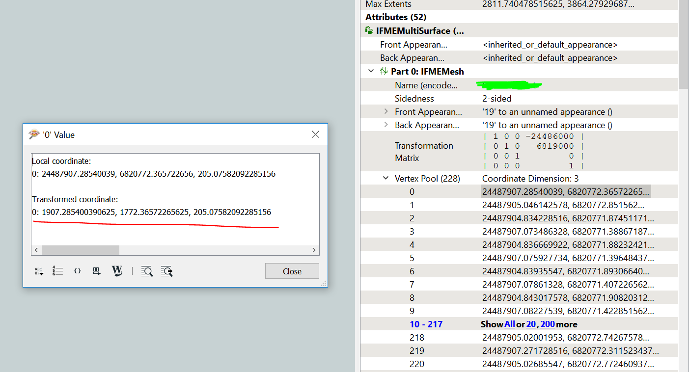
Just noticed that each vertex has correct data I'd like to export as "transformed coordinate" in inspector;
How to export transformed coordinates only, with transformation matrices normalized?
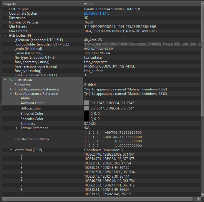
I have the same issue, the software reading my data "demands" a Transofmration matrix of 1,0,0,0 - 0,1,0,0 - 0,0,1,0 - 0,0,0,1. I have tried 3DAffiner, LocalCoordinateSystemsetter, According to the description the: GeometryInstantiator - https://www.safe.com/transformers/geometry-instantiator/ - might work.
Replaces a geometry definition with independent geometry instances that are copies of the original geometry definition. The affine transformation that defined the position of each instance in the geometry definition, including position, scale, and rotation, is applied to each instance.
However it does not sem to work on IFMEMesh and the Vertex pools. I`m afraid I have to deaggregate everything - move the data and then create the Mesh again - which will take a long time to do on a large terrain model. Any good suggestions to try? @daveatsafe might be able to help? As it is also related to https://knowledge.safe.com/answers/90091/view.html -
Hi @sigtill and @kino,
One way is to reproject the mesh:
- CoordinateSystemExtractor to get the current coordinate system in _coordsys attribute
- CsmapReprojector to reproject to local _AZMEA_ coordinate system. Set Vertical Handling to 'Heights are relative to the ellipsoid(s) or geocentric'
- CsmapReprojector to reproject back to coordinate system in attribute _coordsys. Same Vertical Handling.
This process works strictly on the Mesh vertices, and is quite fast.
After offsetting the data, it's in local XY-M coordinates. Then trying to use CsmapReprojector a transformation should be chosen. Tried with auto or none, either won't work. Any idea how to proceed with this method?
I have the same issue, the software reading my data "demands" a Transofmration matrix of 1,0,0,0 - 0,1,0,0 - 0,0,1,0 - 0,0,0,1. I have tried 3DAffiner, LocalCoordinateSystemsetter, According to the description the: GeometryInstantiator - https://www.safe.com/transformers/geometry-instantiator/ - might work.
Replaces a geometry definition with independent geometry instances that are copies of the original geometry definition. The affine transformation that defined the position of each instance in the geometry definition, including position, scale, and rotation, is applied to each instance.
However it does not sem to work on IFMEMesh and the Vertex pools. I`m afraid I have to deaggregate everything - move the data and then create the Mesh again - which will take a long time to do on a large terrain model. Any good suggestions to try? @daveatsafe might be able to help? As it is also related to https://knowledge.safe.com/answers/90091/view.html -
@sigtill did you ever get a working solution to this ?
No-Yes... Not sure . Do you have a small sample dataset with a few features to test?
Not currently, but if you have any method in normalizing transformation matrix, it would do.