I'm trying to move address points from essentially rooftoop locations to the curbside of the address automatically (working with about 10,000 points)
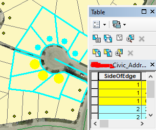
I've got the polygon parcel data, the address point data (contains which side of road the point is located on, but is the only layer I have with this information), and the road polyline.
I thought the best way to set this up would be to move the address points within its containing parcel to the closet edge of the parcel it's contained in. However I think there would be quite a few scenarios where it wouldnt move the point to curbside and so I'm trying to figure out if that is the cleanest approach and how I could set that up, or if theres a better idea.
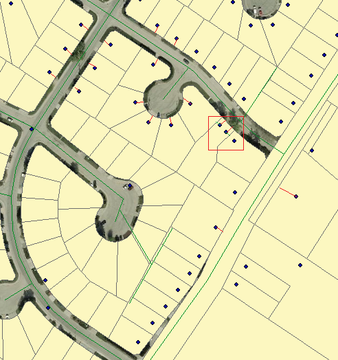
I've added a picture of the layers I'm working with and how I want the points to appear.
Ideally I'd want the points moved to where the end of where I've drawn out the red line would be the ideal goal, however if I were to move points to closest edge of parcel, in the red square outlined area it would probably move it to the end of the green line instead of moving the point closer to curb of the house which is the ultimate goal.


