

I have one large elevation model and numerous smaller elevation models (same resolution) which are within the area of the larger elevation model. The areas of the smaller elevation models are generated from a point cloud and clipped out according to a polygon (bridge). Now I want to merge the smaller elevation model areas into the larger DEM (wherever the smaller elevation models have a value, this should be used and if they have no value, the large elevation model should be used. My attempts with the RasterMosaicer unfortunately fail, because I cannot influence which elevation model is the "last" one. Is there another possibility to combine the different elevation models?

Question
Merging elevation models
This post is closed to further activity.
It may be an old question, an answered question, an implemented idea, or a notification-only post.
Please check post dates before relying on any information in a question or answer.
For follow-up or related questions, please post a new question or idea.
If there is a genuine update to be made, please contact us and request that the post is reopened.


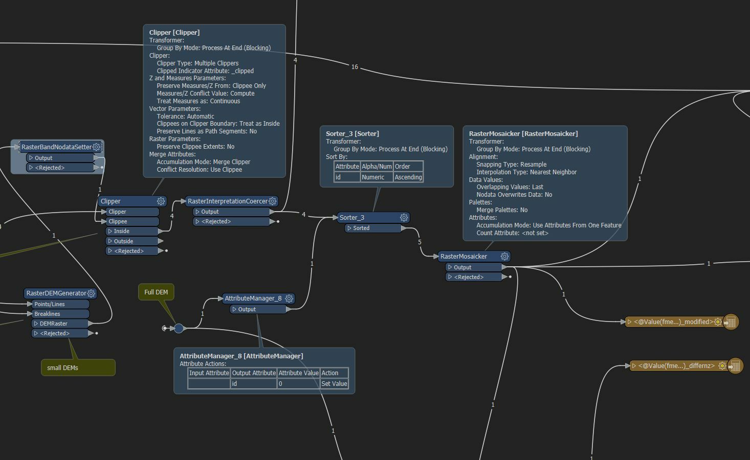 I think the problem is that I am not clear how I can influence the order. I have two inputs:
Login to the community
No account yet? Create an account
An FME Account is required to contribute
LoginEnter your E-mail address. We'll send you an e-mail with instructions to reset your password.