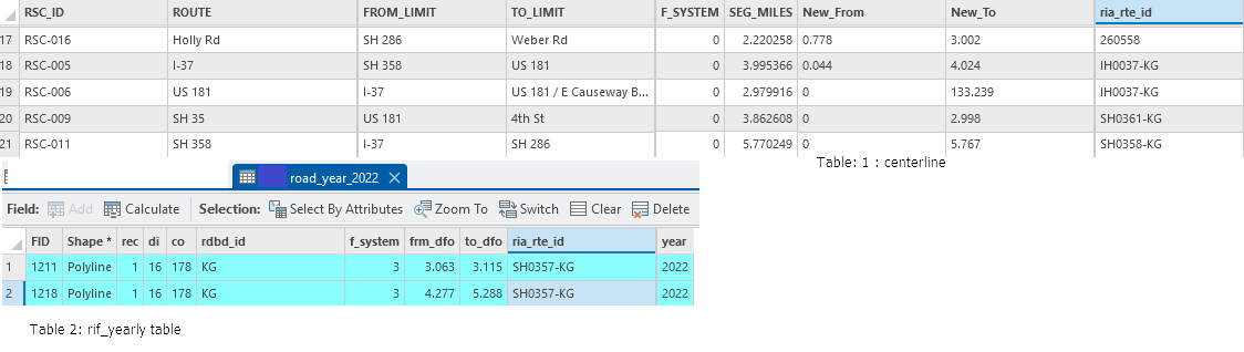
I have a road centerline dataset and RIF network data (one file per year) that includes from_dfo, to_dfo, and ria_rte_id. There are no common fields between the datasets.
I’ve already done a manual match for 2022, where I assigned the starting and ending dfo values (from_dfo, to_dfo) from the RIF layer to each centerline segment — not the in-between segments, just the overall start and end for the full centerline geometry.
Now, I’d like to automate this for other years (e.g., 2021–2017, 2024). My requirements are:
Only extract the overall start and end DFO values for each centerline segment.
One centerline may span multiple RIF segments, so I want the minimum from_dfo and maximum to_dfo from intersecting RIF features.
There are no shared IDs, so I assume the match must be based on spatial overlap.
Is there an efficient way to do this in FME, using spatial join and aggregation (min/max)? Any recommended transformers or workspace suggestion?
Thanks in advance!
herewith I have attached the screenshot of the file showing the table structure.