Hi all,


Im trying to automate a process done in mapinfo and requires a table update.


The update in question-
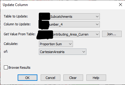
imageimageHope this make sense with the censoring however this shouldn't effect the process.


Ive tried a few different ways but i never get the outcome Im looking for.


Thanks.

Hi @edstrat​ after looking at some of the documentation on the Precisely site, your steps may look something like the following in FME:

  • Read in the table you want to Update and the table you want to Join with
  • Perform your join using the SpatialFilter transformer since you want to perform an intersect
  • You may need to use the StatisticsCalculator or ExpressionEvaluator to calculate the Proportion Sum of CartesianAreaHa


Hopefully this gives you some more information to help you get started


Reply