Hi all,
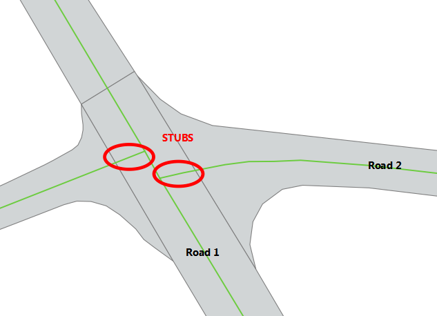
I have a polygon layer representing the sealed area of our road network with numerous attributes about the road. I also have a road centreline layer which has no attribute information. I want to get the road polygon attributes applied the appropriate centreline. The obvious transformer is the LineOnAreaOverlayer, however, this creates a lot of 'stub' centrelines that get associated with an intersecting road (please see image for an example).

In the example, a small section of Road 2 is given the attributes of Road 1.
So far the methodology that I have come up with is to:
1. assign a unique identifier to each centreline
2. process through the LineOnAreaOverlayer
3. determine the lengths of each segment
4. combine segments based on unique identifier
5. use the attributes of segment with the greatest length for the attributes of the centreline
Its not ideal as there is potential for error, so I would be keen to see if anyone else could come up with a better methodology.
Thanks as always!


