I have a bunch of CSV spatial data that have no street location allocated to them. I was wondering if FME can import a basemap of google earth or google maps of my location and using an attribute apply a street name to my csv points?

Solved
It is possible to set a base map on FME so I can see the points more clearly? Also is it possible to get data from a base map ie. street name compared to a csv point?
Best answer by egge
OK - let's elaborate a little bit on the second part of your question: how to find the closest address to each of the latitude/longitude coordinates in your CSV. As @Hans van der Maarel already has indicated, this process is called reverse geocoding. From within the Geocoder transformer you can link to several geocoding services, and for most of them you do indeed need credentials.
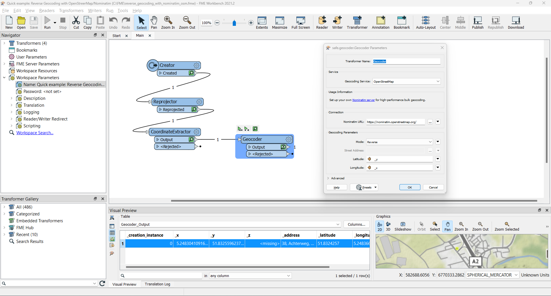
But you might have a look at the OpenStreetMap option, using the (free and) open-source Nominatim geocoder.
Pleas find attached a little example workspace: it creates a point, reprojects it to WGS84 and extracts the coordinates, which are input to the reverse geocoding service. And yes, this provides the _address of our local Dutch office.
HTH,
Egge-Jan
This post is closed to further activity.
It may be an old question, an answered question, an implemented idea, or a notification-only post.
Please check post dates before relying on any information in a question or answer.
For follow-up or related questions, please post a new question or idea.
If there is a genuine update to be made, please contact us and request that the post is reopened.


Login to the community
No account yet? Create an account
An FME Account is required to contribute
LoginEnter your E-mail address. We'll send you an e-mail with instructions to reset your password.