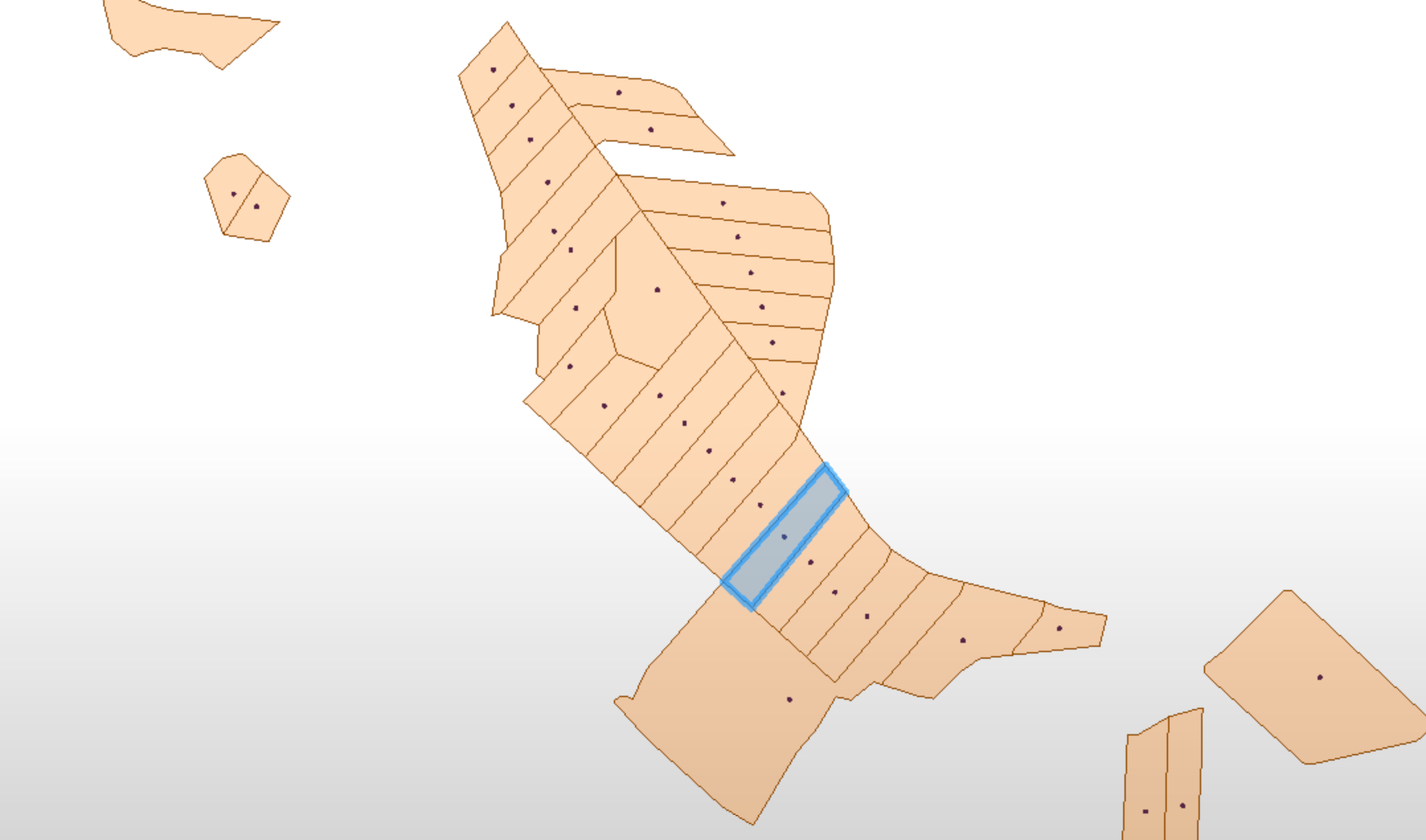
I am trying to find a way to simplify/generalize the dataset below. There are a number of neighbouring plots similar to the one marked in blue. I would like to merge (dissolve) as many as possible of these whilst retaining the overall shape and those plots with more distinctive shapes.
The original features are lines, but in the stage shown below I have created polygons and added a centre point.
The plots I want to merge are rectangle shaped and of similar size. They are of course not true rectangles, that would be to easy, most have around 7-12 vertices.
I tried the FuzzyParallelLineFinder but inner and outer lines where all computed. I want to keep the outer. I have the feeling that dissolving polygons will give me the result I want without having to patch everything up towards the end. But I could of course be wrong about that.
If there is a easier way to do this than the one I suggest below, please let me know!
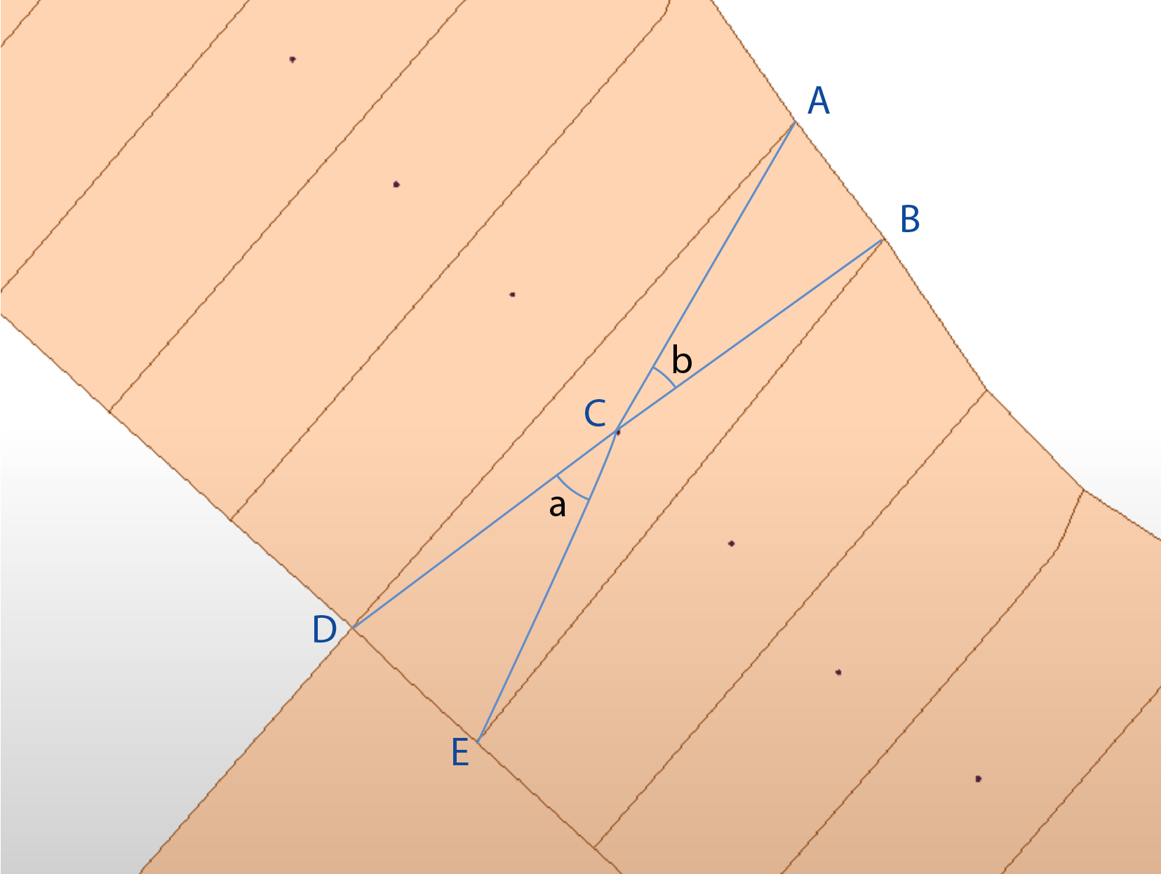
My thinking is that in my "rectangles" the distance from the centre point C to corner A would be similar to that from C to corner B. Same for the other corners. Also the angle a would be similar to the angle b. I use the word similar because I would need to set some sort of tolerance for it to work.
Here is where I get stuck. How do I extract the distances from C to A,B, D and E, and the corresponding angles? Once that is extracted, what transformer would you recomend I use to do the comparative calculations?


