So the result should be a point cloud that has points in a grid of 1m x 1m.
 Personally I would make a DEM with cell size 1m, but that's not what they want.
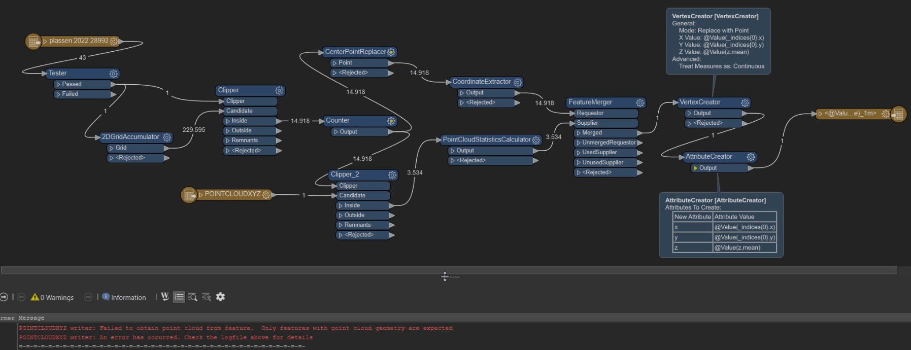
So I have a boundary of the project area. I make a 2dgrid with cell size 1 meter.
I clip the grid, because it's made on the hull of the project area and not the project area itself. Then I use the grid to make points in the center of each cell and also use the grid to clip my point cloud. I use the pointcloudstatisticscalculator to get the mean of the z values within one cell of the grid.
So I can use the X en Y from the center point and have to add the Z from the statisticscalculator. I merge the data together based on the counter I added.
Then I use the vertexcreator to make points with the correct X, Y en Z.
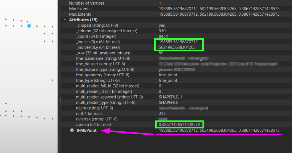
If I inspect these, everything looks good. In the data inspector we see that the points have the correct X, Y en Z.
 The problem is that I can not write the data as point cloud. Not as xyz file and not as las file. I get this errors:
POINTCLOUDXYZ writer: Failed to obtain point cloud from feature. Only features with point cloud geometry are expected
POINTCLOUDXYZ writer: An error has occurred. Check the logfile above for details
Can somebody give me some advice. Maybe there is a much simpeler way, but this is what I came up with...


