Hi,


we have a dwg file and we wanna use this file in a gis software. We are aware that the fme cannot do georeferencing.

Our approuch ist to use the Offsetter transformer to “move” the data to the correct place!

That would be enough for us! So fist we used the AutoCAD DWG/DXW Reader to read the dwg file.

Do we now have to set a coordinate system before using the Offsetter?

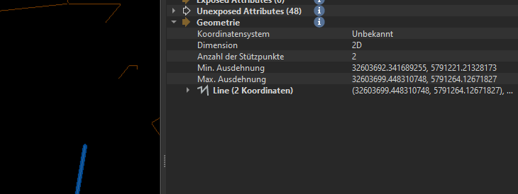
Inside the inspector tha coordinates looks like this:
 

Can anyone help us please?

Multiple ways to do this. You can set the Coordinate System in the (Feature)Reader. Another way is to use a CoordinateSystemSetter.

If the coordinatesystem is in meters (this is usually the case with projected coordinate systems in Europe) and the drawing is in millimeters, you also will have to scale it.


Yes. It is working with Offsetter and afterwards using the “CoordinateSystemSetter”. But I have to set up the X-Offsset -32.000000 to get the right coordinate system (EPSG:25832).


The text positions of some elements look strange. Maybe I have to scale it?


Maybe you can use the Affiner?


Reply