I am testing the OGCAPI of the Norwegian Mapping Authority (https://ogcapitest.kartverket.no/rest/services/havnedata/collections).
It provides five different coordinate reference systems.
- http://www.opengis.net/def/crs/OGC/1.3/CRS84
- http://www.opengis.net/def/crs/EPSG/0/5973
- http://www.opengis.net/def/crs/EPSG/0/25833
- http://www.opengis.net/def/crs/EPSG/0/4326
- http://www.opengis.net/def/crs/EPSG/0/3857
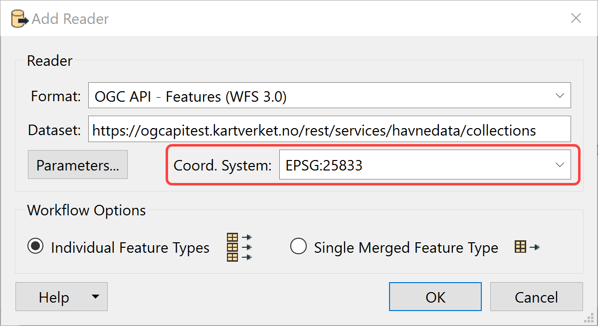
The OGC API – Features Quick Facts suggests that the OGCAPI feature reader supports coordinate systems.
The reader seems to default to WGS84. How can I choose a diffrent CRS in the OGC-API reader?
The call would be like
"http://www.opengis.net/def/crs/EPSG/0/5973&limit=2" alt="https://ogcapitest.kartverket.no/rest/services/havnedata/collections/fender/items?crs=http://www.opengis.net/def/crs/EPSG/0/5973&limit=2" target="_blank">https://ogcapitest.kartverket.no/rest/services/havnedata/collections/fender/items?crs=http://www.opengis.net/def/crs/EPSG/0/5973" ... but how can one provide the crs information in the reader?
Thank you.