Hello everyone.

I work with sewer programs, and found that working with NetworkFlowOrientor can be very helpful in ongoing work.

The purpose for which I use NetworkFlowOrientor is to find mistakes made during autocad typing.

As we know, sewage flows gravitationally so it is important that the beginning of the line be in the high sewer pit and the end point will be in the low sewer pit.

When I work with NetworkFlowOrientor I put the sewer line in line port, And in destination the layer of sewer pits.

When I check the result coming out in GIS, most of the lines that needed to be flipped were flipped.

But about 20% reversed incorrectly.

I guess the problem is in my file, I guess in the sewer pits layer.

So I would like to understand the nature of the NetworkFlowOrientor well.

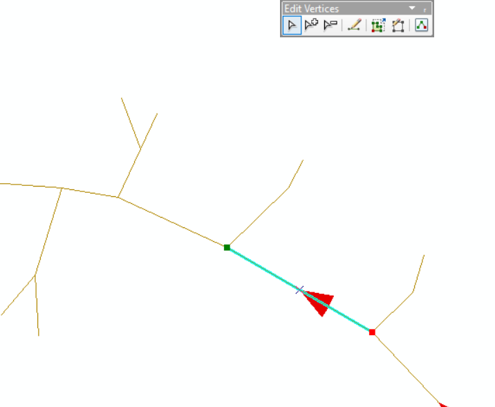
And here's a small example of him turning the line the wrong way.

The arrow indicates the flow direction, here in the original file. (Red is the end of the line)
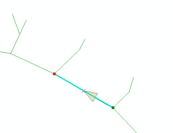
And in the picture here the line flipped over to me, even though it's a mistake.Thanks!
The documentation suggests that NetworkFlowOrientor, for each Line, traces a path to a Destination Point. However, I suspect the really important parameter is the "Group By" Attribute, which limits the tracing and possible flow directions it will calculate in each subnetwork.

Otherwise, problems can come up if you give it just one network to analyse with multiple destinations, because you can get situations where there are competing destination points and the Transformer won't know how to resolve these.

There are a couple of methods typically used in sewerage networks:

  1. One method uses the inverts of the sewer lines themselves. Every Sewer Line Segment is given a Unique ID, and the downstream manhole / sewer pit is similarly tagged with that Sewer Line Segment ID. In this situation the Sewer Line Segment ID can be used as the "Group By" parameter in NetworkFlowOrientor, and it will flip the line to the direction of the nominated downstream manhole / sewer pit . However, determining which manhole / pit is the downstream end is often reliant on good quality sewer pipe invert level data, which is often erroneous.
  2. Probably a more common method is to nominate the subcatchment sewerage wet well / pumping station, or if one doesn't exist, the main drainage point for that subnetwork. This works well when invert level data can be missing or has created inverse graded sewers. However, often in sewerage there can exist multiple wet wells or key drainage points in a subnetwork eg. Wet weather interceptor sewers that divert overflows or surcharges to another drainage point. The key to getting the correct flow direction is to attribute these special flow diversion sewer lines separately because they may get calculated as flowing towards the normal (dry weather) wet well / drainage point instead of pointing away from it.

The key to both will be adequate attribution on the network lines and network flow destinations to allow them to be analysed in separate and unique groups in order for NetworkFlowOrientor being able to derive the correct flow direction.


Reply