Question

GIS to CAD - Annotations too big

  • March 2, 2020
  • 1 reply
  • 35 views

philippeb
Enthusiast
Forum|alt.badge.img+22

Hi there,

Using FME 2019.1, trying to convert GIS annotations (ArcSDE) to DWG.

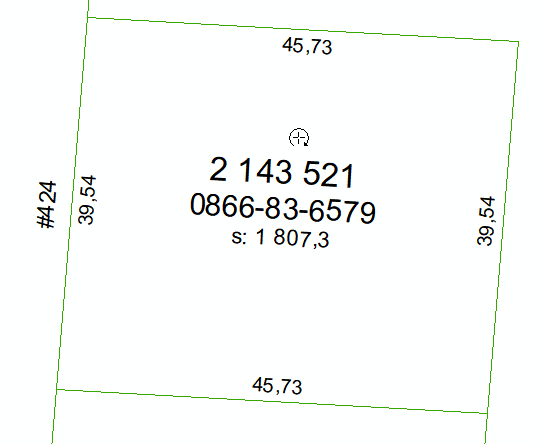
This is an example of my data source in ArcGIS.

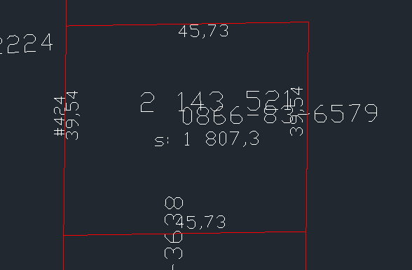
This is the final result in AutoCAD. Why am I getting those big disproportionate ugly annotations?

Is there anything I can do? TX

This post is closed to further activity.
It may be an old question, an answered question, an implemented idea, or a notification-only post.
Please check post dates before relying on any information in a question or answer.
For follow-up or related questions, please post a new question or idea.
If there is a genuine update to be made, please contact us and request that the post is reopened.

1 reply

deanhowell
Influencer
Forum|alt.badge.img+24
  • Influencer
  • 315 replies
  • March 2, 2020

Part of the issue could be the font being used in the CAD drawing is not the same as the GIS.

There is an autoCAD attribute called 'autocad_font_typeface' which you could set to the same font used in the GIS file before you output top DWG.

There is a post which may also help https://knowledge.safe.com/questions/105764/is-there-a-way-to-control-the-size-of-labels-withi.html which discussed the AutoCAD text size.

Hope that helps :)