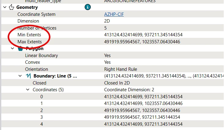
so i have this polygon and i can see the min extents and max extents in the record information window. i know that i can get the coordinates and calculate the length and width of the polygons, but i’m interested to know if the min and max entents in the geometry portion of the Record Information can be obtained directly?