Solved

Geotiff is placed different between FME and QGIS


mathiku
Supporter
Forum|alt.badge.img+7

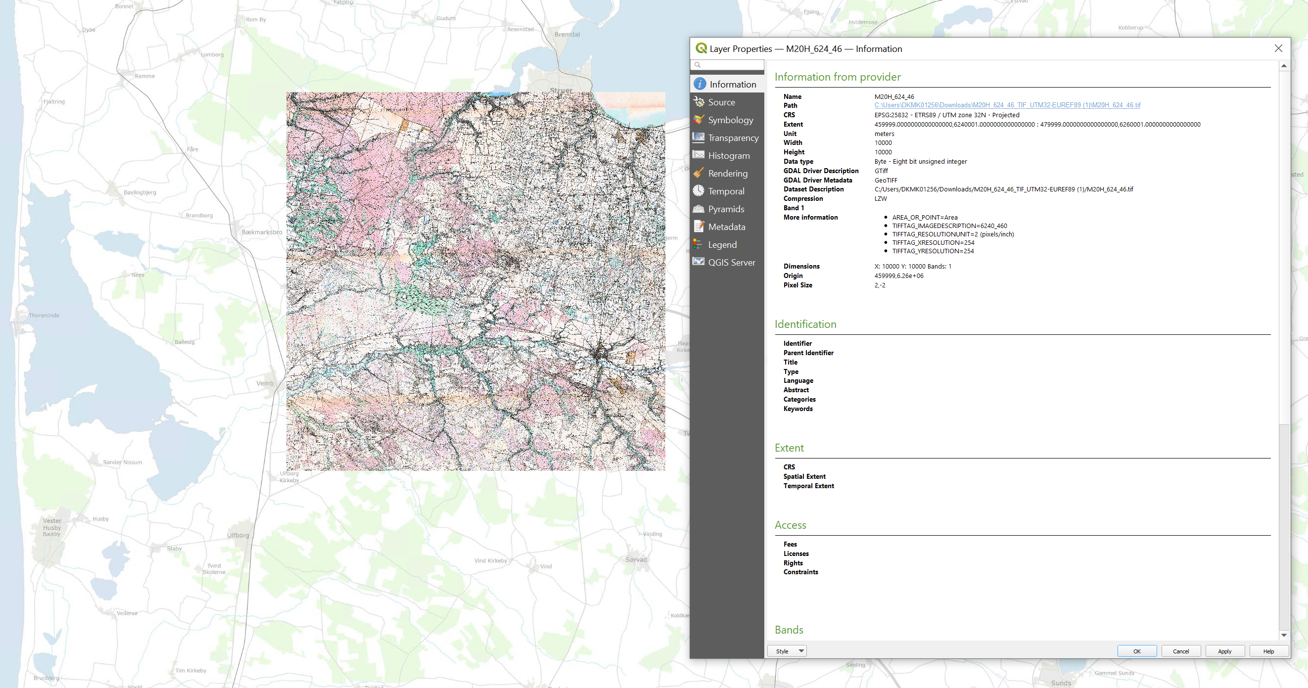
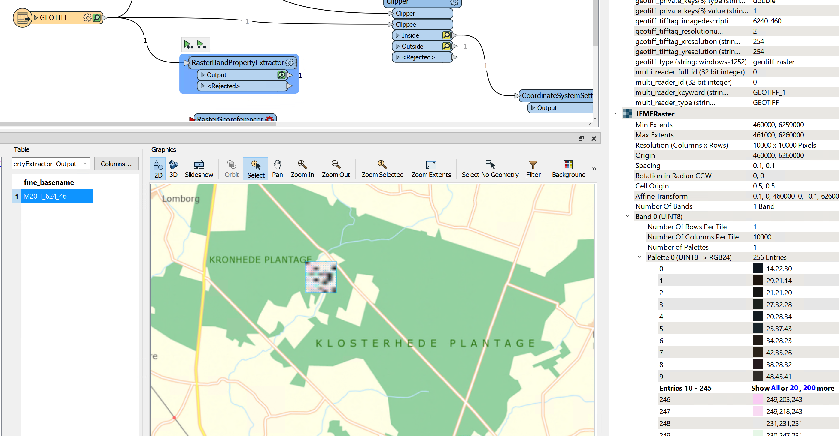
The same geotiff is placed differently in QGIS (3.22) and FME (2022). QGIS is placing it correctly, or at least as intended by the publisher, and shows a cellsize of 2x2m. FME is setting the cellspacing at 0.1x0.1m.

Can somebody explain the difference in interpretation? And possibly how to fix it in FME - in general, not via georeferencer?

The original file can be accessed here: https://drive.google.com/file/d/1b9Euqly7DPwwYzEvLNqWj1JgxAGbTBqI/view?usp=sharing

/Mathias

GEOTIFF QGIS correct interpretation- 2022-04-03 10_00_56-dkpc-mm131406 - Remote Desktop ConnectionGEOTIFF misinterpretation - 2022-04-03 10_00_56-dkpc-mm131406 - Remote Desktop Connection

Best answer by hkingsbury

The world file (.tfw) that is with that image seems to be incorrect. It is specifying that the cell sizes are .1x.1. If you delete the world file and open the image it will be in the same place as it is in QGIS

View original
Did this help you find an answer to your question?

2 replies

hkingsbury
Celebrity
Forum|alt.badge.img+55
  • Celebrity
  • Best Answer
  • April 4, 2022

The world file (.tfw) that is with that image seems to be incorrect. It is specifying that the cell sizes are .1x.1. If you delete the world file and open the image it will be in the same place as it is in QGIS


mathiku
Supporter
Forum|alt.badge.img+7
  • Author
  • Supporter
  • April 4, 2022
hkingsbury wrote:

The world file (.tfw) that is with that image seems to be incorrect. It is specifying that the cell sizes are .1x.1. If you delete the world file and open the image it will be in the same place as it is in QGIS

Thank you. Can't believe I didn't check the world file.


Cookie policy

We use cookies to enhance and personalize your experience. If you accept you agree to our full cookie policy. Learn more about our cookies.

 
Cookie settings