Hey there,
I’ve been struggling with a geometry problem. Here’s the thing :)
I’m merging two datasets of building polygons. Both come from SDE geodatabases and both appear fine in Esri ArcMap and ArcGIS Pro.
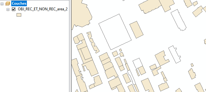
When I put theses geometries through a PointOnAreaOverlayer, some polygons, when written to a file geodatabase have weird behaviours in ArcMap and Pro.
Their contour draws OK but they don’t fill ! 🤣

The way I solved the problem was by using a GeometryExtractor before the PointOnAreaOverlayer and GeometryReplacer after it.
To me this is weird, eventhough I know there are problematic geometries in there.
Besides, I tried to solve the problem with a GeometryValidator but that create many more errors. 🙄
If you have any insights about this, I’ll be happy.


