Hello, 

I want to create a raster for each different source_point_id (number of flighline) in a single las file.

Do you know how to extract the source point id from the las file in order to generate a raster on the points of the chosen source_id point?


thanks you for your help!

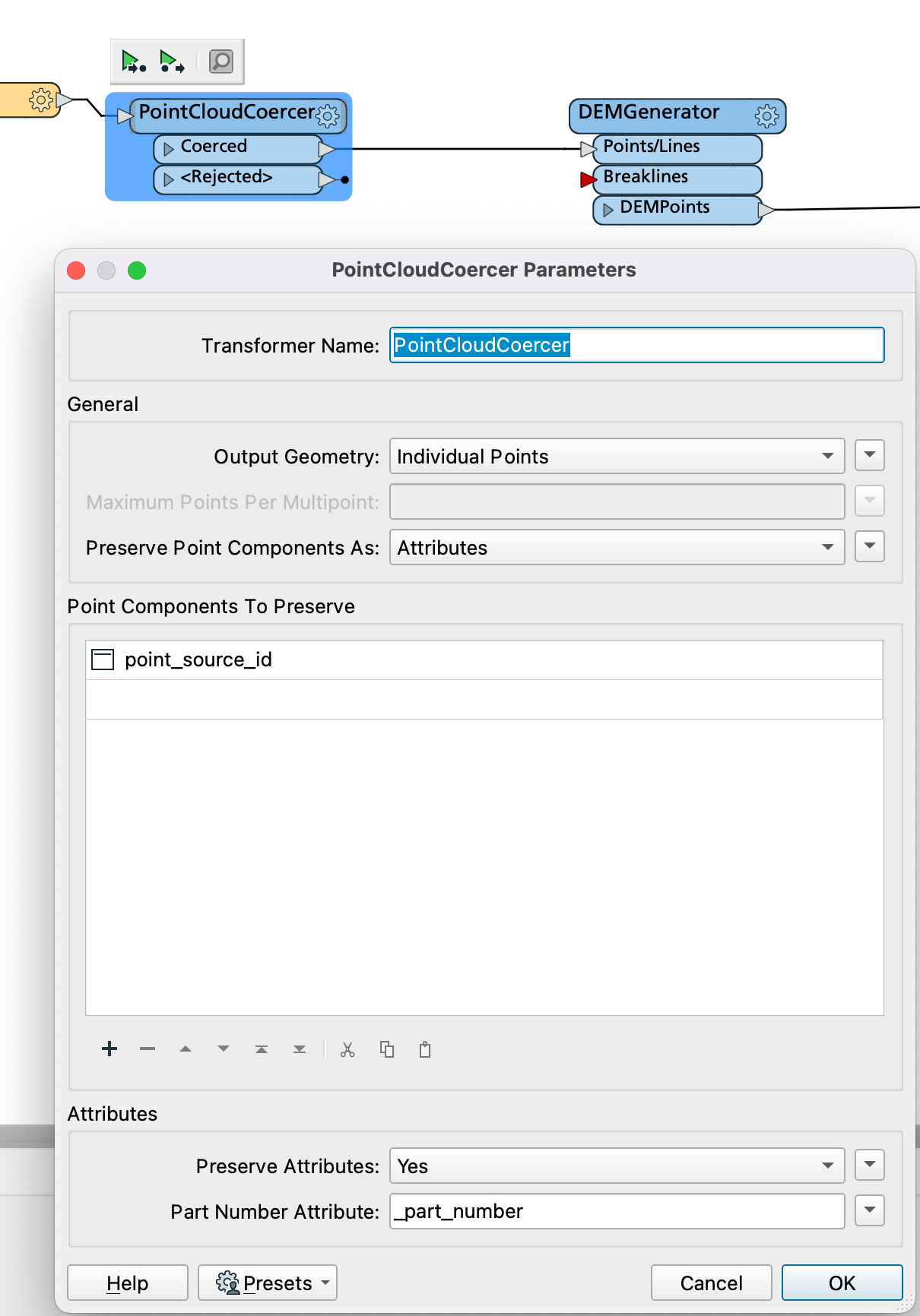
If you can expose that attribute (my sample LAS seems to have it as point_source_id) you can use the Group By option on the DEMGenerator (and/or SurfaceModeller) to generate separate DEM's for all unique values of that attribute.


The trick is to get that attribute, a PointCloudCoercer can do that for you, but has the downside of breaking down the point cloud into individual points, so you do get a big performance hit.

Yes but how to extract point_source_id in my las file to use group by in DEMgenerator?

It is this point_source_id information that I can't get out of my las file.


Yes but how to extract point_source_id in my las file to use group by in DEMgenerator?

It is this point_source_id information that I can't get out of my las file.

That can be specified in the PointCloudCoercer:

Screenshot 2022-04-22 at 10.39.33


Yes but how to extract point_source_id in my las file to use group by in DEMgenerator?

It is this point_source_id information that I can't get out of my las file.

Thanks you very much!

It's the result I wanted


Yes but how to extract point_source_id in my las file to use group by in DEMgenerator?

It is this point_source_id information that I can't get out of my las file.

You're welcome!


Reply