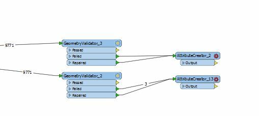
Hi @dfresh, I think it has been caused by a difference between implementations of extrenal libraries - Esri ArcObjects (GEODATABASE_FILE) and File Geodatabase Open API (FILEGDB).
Esri ArcGIS has some tolerance internally, so I suspect that the GEODATABASE_FILE reader (Arc Objects) could repair invalid geometries implicitly in some cases.
I'm interested in what happens if you insert the ArcSDEGridSnapper after the FILEGDB reader.
I agree. Maybe even try a CoordinateRounder after both of the readers and before the GeometryValidators..
What happens if you attach a GeometryFilter to each Reader?
Are they single part or multi-part features? Would de-aggregating help?
Note also that the ordering of the issues in the GeometryValidator can change the output geometries.
These links may also be useful:
https://knowledge.safe.com/articles/173/what-is-the-arcsdegridsnapper.html
http://edndoc.esri.com/arcsde/9.3/concepts/geometry/shapes/verificationrules.htm
http://help.arcgis.com/en/arcgisdesktop/10.0/help/index.html#//006z00000028000000