Question

Do not convert DWG to GeoTIFF

  • August 20, 2021
  • 1 reply
  • 36 views

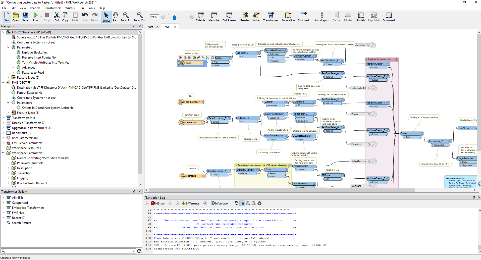
I have a *DWG file. I want to convert it to GeoTIFF. I used tool from link: https://hub.safe.com/publishers/safe-lab/templates/converting-vector-data-to-raster#description.

Even though it exports successfully, I don't see the GeoTIFF output.

What step am I doing wrong?

Please tell me. Thanks

20-08-2021 14-33-49

1 reply

caracadrian
Contributor
Forum|alt.badge.img+23
  • Contributor
  • August 20, 2021

The log file says 0 (zero) features output.

The example here is very old and I think it was flawed to begin with:

  • DonutBuilder should be set to Drop Holes = Yes
  • tile_boundary in buffered with an interpolation angle of 0 - should have a float grater than 0 (put 0.01)
  • 2DEllipseReplacer on elevations dataset has to create a circle (primary and secondary axis are set to 1) in a LatLong system that is reprojected somewhere down the line. A circle with the radius of 1 degree (as in measurement of arc distance not angle) is of greater area than all other features present in the workspace (put 0.0001) - You should never create circles in a LatLong coordinate system, reproject first...
  • Rasterizer1 should have a specified PATH (maybe the setting worked in 2011 but 10 years of development changes things), just browse to a folder that you want the tiff to be exported to and click OK.

Cookie policy

We use cookies to enhance and personalize your experience. If you accept you agree to our full cookie policy. Learn more about our cookies.

 
Cookie settings