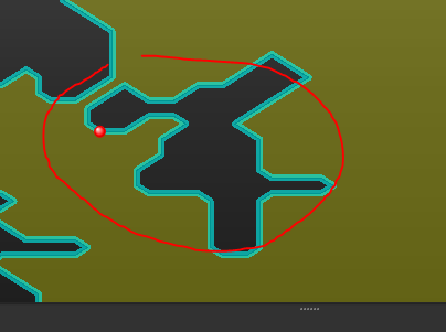
Hello - I have a dataset of polygons (some of which are donut polygons). Some of these polygons contain multiple parts (i.e. more than one polygon per record). When I run this dataset through an AreaOnAreaOverlayer it seems that some of the multiple polygon parts are lost. This is shown in a comparison of 'DataExtent.png' with 'AonA_Output_Extent.png'.
I have tried running the polygon dataset through a Deaggregator thinking this would split records with multiple geometries in to multiple records (in case multiple polygons per record was causing an issue for the AreaOnAreaOverlayer). However the output from the Deaggregator is untouched regardless of the settings in the transformer (so perhaps these are not aggregates).
Ultimately I need to run these polygons through the AreaOnAreaOverlayer but need all parts to be considered.
The data was initially stored in an Esri file geodatabase and I've also tried as a Mapinfo .TAB but am getting the same results. I have also included a link below to the data stored as a .shp file.
Apologies if I'm missing something obvious here but I'm really puzzled as these transformers are not behaving as I'd have expected. Any suggestions would be very gratefully received!
Thanks and all the best,
Matt


