Question

AreaCalculator calculating different areas for the same feature


aditi21698
Contributor
Forum|alt.badge.img+1

Hi all, 

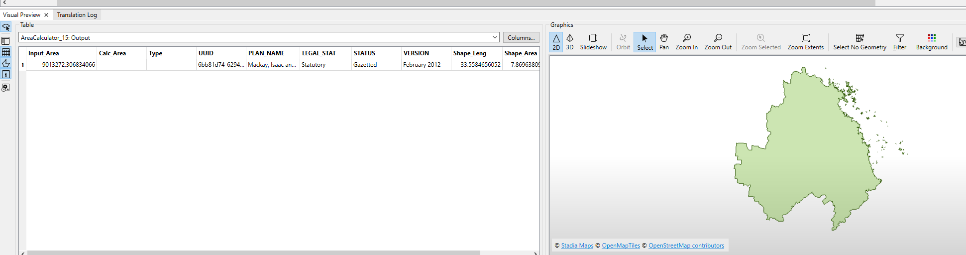
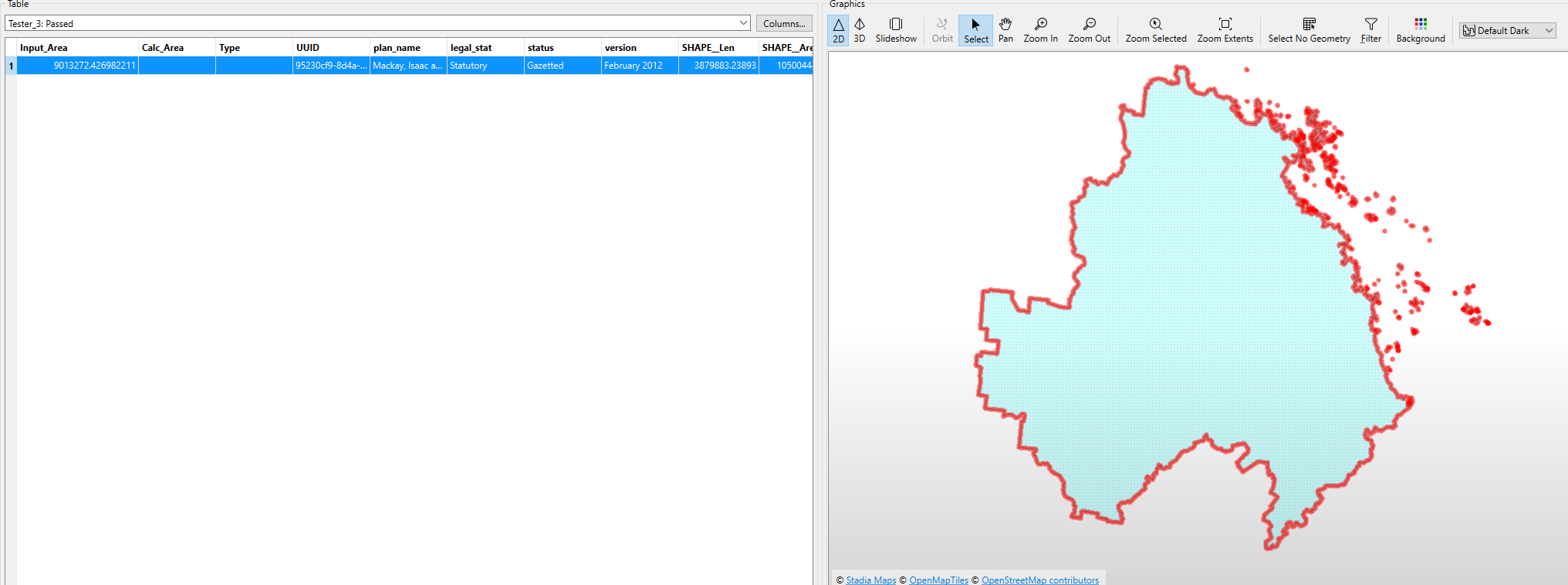
I have a workspace that preps all input features by reprojecting them to GDA94/ Australian Albers and then calculates input area. When I run the same feature (as a shapefile, but different different coordinate systems) I get different Area values even though they’re both in the same Coordinate System.

I ended up testing the features with an AreaOnAreaOverlayer and turns of there’s really tiny slivers across the boundary of the feature (I don’t know where these slivers are coming from?). I added both the shapefiles in ArcGIS Pro and followed the same process- reproject and calculate area and both area values are coming out as the same in Pro. 

I am unable to figure out why I’m getting this difference in areas in FME but not ArcGIS Pro. The difference is tiny but ends up changing the final stats.

Screenshots attached. 

Any help would be greatly appreciated. 


9 replies

redgeographics
Celebrity
Forum|alt.badge.img+49

So just to clarify, are these separate runs of the same feature that yield different results? And by same feature I mean coming from the same source.


When I run the same feature (as a shapefile, but different different coordinate systems) I get different Area values even though they’re both in the same Coordinate System.


This is confusing me a bit (are or aren’t they in the same coordinate system before reprojecting?). A clue might be in the format though, coordinate accuracy in shapefile vs. another format might cause tiny differences.


j.m-visma
Contributor
Forum|alt.badge.img+5
  • Contributor
  • March 12, 2025

@aditi21698  Have you tried running a generalizer? If that stabilizes the result, then FME is probably rounding differently somewhere in the Flow.


aditi21698
Contributor
Forum|alt.badge.img+1
  • Author
  • Contributor
  • March 12, 2025

@redgeographics thanks for your response! yes, separate runs of the same feature from the same source just exported with different coordinate systems. They have different coordinate systems before reprojecting. 


aditi21698
Contributor
Forum|alt.badge.img+1
  • Author
  • Contributor
  • March 12, 2025

Unfortunately using a generalizer did not work, my process needs the shape with all vertices to be preserved to generate specific land use, economic stats etc


redgeographics
Celebrity
Forum|alt.badge.img+49
aditi21698 wrote:

@redgeographics thanks for your response! yes, separate runs of the same feature from the same source just exported with different coordinate systems. They have different coordinate systems before reprojecting. 

Okay, so if I understand you correctly they have different coordinate systems at the time the area is calculated.

If that is the case I am not surprised. Based on the specs and properties of the coordinate systems different areas would be an expected result. Even if they are both Equal Area coordinate systems, the reprojecting may introduce small differences.


j.m-visma
Contributor
Forum|alt.badge.img+5
  • Contributor
  • March 13, 2025

@aditi21698 you could try the CsmapReprojector and see if there are any transformation algorithms that are closer together in result, but ultimately as ​@redgeographics says, reprojection will introduce small differences unless you use the same transformation algorithm on both.


aditi21698
Contributor
Forum|alt.badge.img+1
  • Author
  • Contributor
  • March 19, 2025

thanks all, I don’t think I was clear enough- the two shapefiles have different coordinate systems when introduced into the workspace but they are reprojected to the same CS (GDA-94/Aus Albers) before we calculate the area of the feature. The shapefiles were created from the same file in ArcGIS Pro. 

I’m using the PROJ_Reprojector which is able to identify the source CS and reproject it to a defined CS (in my case GDA94/AA) 


philipwhitten
Contributor
Forum|alt.badge.img+11

Can you provide the settings that you are using for PROJ_Reprojector?  Also, Can you also provide the messages in the Translation Log for ProjReprojector?  FME can make the wrong transformation if you are using a “Automatic Transformation”.  For example, if you are a reprojecting from Web Mercator (EPSG 3857) than FME will assume it is aligned with GDA94 even if you have aligned it with GDA2020.  


j.m-visma
Contributor
Forum|alt.badge.img+5
  • Contributor
  • March 20, 2025

@aditi21698 have you tried the ESRIreprojector by the way?
 

Edit. If the problem occurs due to reprojection and ArcGIS Pro doesn't have it, then maybe using the ESRI reprojector will just resolve the issue.


Reply


Cookie policy

We use cookies to enhance and personalize your experience. If you accept you agree to our full cookie policy. Learn more about our cookies.

 
Cookie settings