Hi All,
Need your help fix the below scenario,
I have a dataset approximately 100,000 records and these records have Polygon geometry
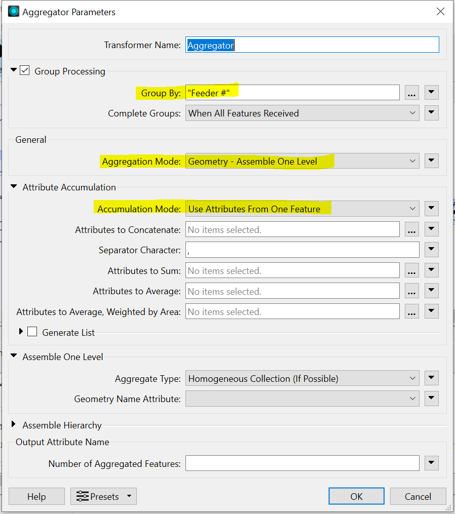
I am using "aggregator" transformer to group the records as per column attribute and it creates 100 aggregated records.
My requirement is to show each aggregated record as 1 shape on the map when user clicks on it.
Issue: I am facing issue with geometry aggregation. When I plot data on ArcGIS online, I see all 100 aggregated records, but see some empty spots on the map.
If I plot the same data on map without aggregating it, it plots fine.
looks like something is going wrong with geometry aggregation.
Would really appreciate if you could provide some input on how to handle it.
Below is the configuration of my Aggregator transformer,
Thanks,