
Using my basic FME skills, I've been able to automate the download of the OS Mastermap Topographic Area, Line and Point but am struggling over how to maintain the changehistory feature collection type which FME wants to insert a single value.
Being a common task amongst many GIS users, I would hope there are some models out there....?


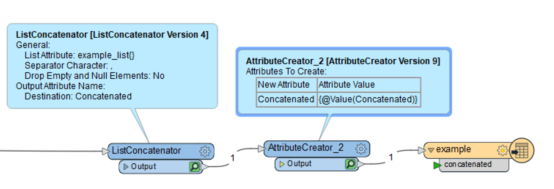 This allowed us to maintain the changehistory feature collection information for each feature. Best, Kailin.