Question

Align CAD to GIS layer

  • December 27, 2017
  • 2 replies
  • 15 views

apence231
Contributor
Forum|alt.badge.img+10

I have a CAD file that looked to be in local coordinates and I finally found the handy tool 'Local Coordinate System Setter' and I reprojected it into state plane and almost got the CAD drawing in the correct location but it is still off by a bit and not sure what I am missing.

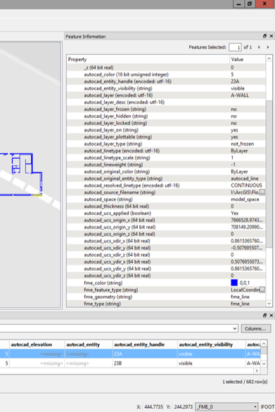
I've tried the Affiner tool to get the direction correct since i noticed in the CAD drawing it has _xdir_x and _ydir_y and so on.

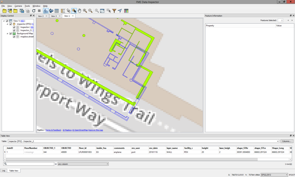
Adding those directions into the Affiner tool, it rotated at least correctly but not quite in the right location (blue CAD, green GIS):

Is there another tool that i need to use to make it align better or at least get the CAD drawing in the exact locations?

Thanks!

2 replies

erik_jan
Contributor
Forum|alt.badge.img+18
  • Contributor
  • December 27, 2017

If all coordinates are off in the X and Y direction by the same distance, you could use the Offsetter to correct that.


apence231
Contributor
Forum|alt.badge.img+10
  • Author
  • Contributor
  • December 27, 2017
erik_jan wrote:

If all coordinates are off in the X and Y direction by the same distance, you could use the Offsetter to correct that.

It's always the most simple things sometimes! Don't know how i missed that, but using offsetter and also rotator i was able to align it and then I used snapper to get it all set up. Thanks for helping me with the brain-fart.


Cookie policy

We use cookies to enhance and personalize your experience. If you accept you agree to our full cookie policy. Learn more about our cookies.

 
Cookie settings